Župančiči
Place in Littoral, Slovenia
45°28′59.06″N 13°46′0.06″E / 45.4830722°N 13.7666833°E / 45.4830722; 13.7666833 Slovenia
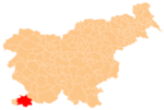
 (2002)
Župančiči (pronounced [ʒuˈpaːntʃitʃi], Italian: Zupancici [2]) is a small settlement in the City Municipality of Koper in the Littoral region of Slovenia.[3]
Geography
Župančiči is located in a narrow valley above the right bank of the Rokava River. There are fertile tilled fields in the valley, and the surrounding slopes have pastures, meadows, and sparse woods.[4]
Name
The name Župančiči is plural, presumably referring to former residents with the surname Župančič. The surname is derived from the common noun župan, referring to a local leader, and has given rise to other toponyms, such as Županje Njive.[5] Locally, the village is known as Flegi.[4]
References
- ^ Statistical Office of the Republic of Slovenia
- ^ Spezialortsrepertorium der österreichischen Länder. Bearbeitet auf Grund der Ergebnisse der Volkszählung vom 31. Dezember 1910, vol. 7: Österreichisch-Illyrisches Küstenland. Vienna: K. k. Hof- und Staatsdruckerei. 1918. p. 35.
- ^ Koper municipal site
- ^ a b Savnik, Roman (1968). Krajevni leksikon Slovenije, vol. 1. Ljubljana: Državna založba Slovenije. p. 147.
- ^ Snoj, Marko (2009). Etimološki slovar slovenskih zemljepisnih imen. Ljubljana: Modrijan. pp. 492–493.
External links
 Media related to Župančiči at Wikimedia Commons
- Župančiči on Geopedia
- v
- t
- e
Administrative seat: Koper
| Current |
|
|---|---|
| Former |
|

| Koper |
|
|---|---|
| Elsewhere |
|
people
- Zvest Apollonio
- Gian Rinaldo Carli
- Vittore Carpaccio
- Boris Cavazza
- Giorgio Cobolli
- Lucija Čok
- Zlatko Dedić
- Lorella Flego
- Pier Antonio Quarantotti Gambini
- Lucrezio Gravisi
- Franco Juri
- Tinkara Kovač
- Igor Pribac
- Tomaž Šalamun
- Santorio Santorio
- Nazario Sauro
- Spartaco Schergat
- Francesco Trevisani
- Pier Paolo Vergerio
- Pier Paolo Vergerio the Elder
- Vittorio Italico Zupelli


