Ardgarvan
Hamlet in County Londonderry, Northern Ireland
Townland in Northern Ireland, United Kingdom
Ardgarvan Irish: Ard Garbháin[1] | |
|---|---|
townland | |
| Irish transcription(s) | |
| • Derivation: | Ard Garbháin |
| • Meaning: | "Garvan's height" |
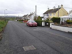 Ardgarvan in 2008 | |
55°01′23″N 6°55′44″W / 55.023°N 6.929°W / 55.023; -6.929 | |
| Sovereign state | United Kingdom |
| Country | Northern Ireland |
| County | Londonderry |
| Barony | Keenaght |
| Civil parish | Drumcahose |
| Settlements | Ardgarvan |
| Government | |
| • Council | Causeway Coast and Glens |
| Area | |
| • Total | 286.27 acres (115.85 ha) |
Ardgarvan (from Irish Ard Garbháin, meaning 'Garvan's height')[1] is a hamlet and townland in County Londonderry, Northern Ireland, 2 km south of Limavady. In the 2001 Census it had a population of 111 people. It is situated within Causeway Coast and Glens district.[3]
The village has developed on the northern side of Ballyavelin Road and is dominated by public housing development. It has limited recreational facilities available to the local community.[3]
See also
References
- ^ a b Placenames Database of Ireland
- ^ Northern Ireland Environment Agency. "NIEA Map Viewer". Archived from the original on 24 November 2011. Retrieved 27 January 2012.
- ^ a b "Ardgarvan Settlement Designation". Planning Service - Draft Northern Area Plan 2016. Retrieved 23 June 2008.[permanent dead link]
- v
- t
- e
Places in County Londonderry
- Derry

and townlands
- Aghadowey
- Altnagelvin
- Ardgarvan
- Ardmore
- Articlave
- Artikelly
- Ballerin
- Ballyhanedin
- Ballykelly
- Ballylifford
- Ballymaguigan
- Ballynagalliagh
- Ballyrashane
- Ballyronan
- Ballyrory
- Ballyscullion
- Banagher
- Bellaghy
- Bellarena
- Benone
- Bogside
- Broighter
- Burnfoot
- Campsey
- Carrowclare
- Castledawson
- Castlerock
- Clady
- Claudy
- Coagh
- Culmore
- Culnady
- Curran
- Derrynaflaw
- Desertmartin
- Downhill
- Draperstown
- Drumahoe
- Drummullan
- Drumraighland
- Drumsurn
- Eglinton
- Elagh More
- Feeny
- Foreglen
- Garvagh
- Glack
- Glenone
- Gortnahey
- Goshedan
- Greysteel
- Gulladuff
- Inishrush
- Kilcronaghan
- Killaloo
- Killywool
- Kilrea
- Knockloughrim
- Largy
- Lavey
- Lenamore
- Lettershandoney
- Lisbunny
- Lissan
- Macosquin
- Maghera
- Magilligan
- Maydown
- Moneymore
- Moneyneany
- Newbuildings
- Nixon's Corner
- Park
- Prehen
- Ringsend
- Shantallow
- Shanvey
- Straidarran
- Strathfoyle
- Straw
- Swatragh
- Tamlaght
- Tamnaherin
- The Loup
- Tobermore
- Upperlands
- WikiProject Northern Ireland
- WikiProject Ireland
- Northern Ireland Portal
- United Kingdom Portal
- Ireland Portal
 | This article related to the geography of County Londonderry, Northern Ireland is a stub. You can help Wikipedia by expanding it. |
- v
- t
- e


