Artas, Isère
Commune in Auvergne-Rhône-Alpes, France
Location of Artas

(2020–2026) Martial Simondant[1]
1
(2021)[2]
38015 /38440
Artas (Occitan: Artàs) is a commune in the Isère department in the Auvergne-Rhône-Alpes region of south-eastern France.
Geography
Artas is located some 20 km east by north-east of Vienne and some 8 km south of Villefontaine. Access to the commune is by the D53 road from Charantonnay in the west passing through the heart of the commune and the village and continuing to Saint-Agnin-sur-Bion in the east. The D126 road comes from Roche in the north through the heart of the commune and crossing the D53 in the village before continuing to Saint-Jean-de-Bournay in the south. Apart from the village there are also the hamlets of Le Barroz, Le Revolet, Cinquin, Radoire, Tarnezieux, and La Petite-Foret. The commune is mainly farmland with scattered forests throughout.[3]
The Ruisseau de Charavoux rises in the west of the commune and flows west to join the Ambalon near Chasse-sur-Rhône.[3]
Neighbouring communes and villages
Places adjacent to Artas, Isère | |
|---|---|


History
In the reign of Louis XIV the Oak trees from the Artas Forest provided a large part of the wood needed to build the King's Galleys at Marseille.
Artas was the birthplace of Mother's Day in France on 10 June 1906 - two years earlier than the date of origin of 1908 claimed by the USA.[4]
Administration

This list is incomplete; you can help by adding missing items. (April 2021) |
List of Successive Mayors[5]
| From | To | Name | Party |
|---|---|---|---|
| 2001 | 2014 | Maurice Barale | UMP |
| 2014 | 2026 | Martial Simondant |
Demography
The inhabitants of the commune are known as Artasiens or Artasiennes in French.[6]
|
| ||||||||||||||||||||||||||||||||||||||||||||||||||||||||||||||||||||||||||||||||||||||||||||||||||||||||||||||||||
| |||||||||||||||||||||||||||||||||||||||||||||||||||||||||||||||||||||||||||||||||||||||||||||||||||||||||||||||||||
| Source: EHESS[7] and INSEE[8] | |||||||||||||||||||||||||||||||||||||||||||||||||||||||||||||||||||||||||||||||||||||||||||||||||||||||||||||||||||

Sites and monuments

- A Church with two bell towers from the 12th and 19th centuries.
Artas Picture Gallery
-
 Artas Girls' School
 -
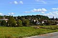 Artas Landscape
 -
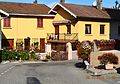
 The old Town Hall
 -
 A street in Artas


See also
References
- ^ "Répertoire national des élus: les maires". data.gouv.fr, Plateforme ouverte des données publiques françaises (in French). 2 December 2020. Archived from the original on 28 June 2020. Retrieved 7 May 2024.
- ^ "Populations légales 2021". The National Institute of Statistics and Economic Studies. 28 December 2023.
- ^ a b c Google Maps
- ^ Artas Official website Archived 27 May 2012 at the Wayback Machine (in French)
- ^ List of Mayors of France Archived 29 April 2014 at the Wayback Machine (in French)
- ^ Le nom des habitants du 38 - Isère Archived 8 December 2015 at the Wayback Machine, habitants.fr
- ^ Des villages de Cassini aux communes d'aujourd'hui: Commune data sheet Artas, EHESS (in French).
- ^ Population en historique depuis 1968 Archived 28 September 2022 at the Wayback Machine, INSEE
External links
- Artas official website (in French)
- Artas on the National Geographic Institute website (in French)
- Artas on Géoportail, National Geographic Institute (IGN) website (in French)
- Artas on the 1750 Cassini Map
Wikimedia Commons has media related to Artas (Isère).
- v
- t
- e

- Les Abrets en Dauphiné
- Les Adrets
- Agnin
- L'Albenc
- Allemond
- Allevard
- Ambel
- Anjou
- Annoisin-Chatelans
- Anthon
- Aoste
- Apprieu
- Arandon-Passins
- Artas
- Assieu
- Auberives-en-Royans
- Auberives-sur-Varèze
- Auris
- Autrans-Méaudre-en-Vercors
- Les Avenières-Veyrins-Thuellin
- Avignonet
- La Balme-les-Grottes
- Barraux
- La Bâtie-Montgascon
- Beaucroissant
- Beaufin
- Beaufort
- Beaulieu
- Beaurepaire
- Beauvoir-de-Marc
- Beauvoir-en-Royans
- Bellegarde-Poussieu
- Belmont
- Bernin
- Besse
- Bessins
- Bévenais
- Bilieu
- Biol
- Biviers
- Bizonnes
- Blandin
- Bonnefamille
- Bossieu
- Le Bouchage
- Bougé-Chambalud
- Le Bourg-d'Oisans
- Bourgoin-Jallieu
- Bouvesse-Quirieu
- Brangues
- Bressieux
- Bresson
- Brézins
- Brié-et-Angonnes
- Brion
- La Buisse
- La Buissière
- Burcin
- Cessieu
- Châbons
- Chalon
- Chamagnieu
- Champagnier
- Champier
- Le Champ-près-Froges
- Champ-sur-Drac
- Chamrousse
- Chanas
- Chantepérier
- Chantesse
- Chapareillan
- La Chapelle-de-la-Tour
- La Chapelle-de-Surieu
- La Chapelle-du-Bard
- Charancieu
- Charantonnay
- Charavines
- Charette
- Charnècles
- Charvieu-Chavagneux
- Chasse-sur-Rhône
- Chasselay
- Chassignieu
- Château-Bernard
- Châteauvilain
- Châtel-en-Trièves
- Châtelus
- Châtenay
- Châtonnay
- Chatte
- Chavanoz
- Chélieu
- Chevrières
- Le Cheylas
- Cheyssieu
- Chèzeneuve
- Chichilianne
- Chimilin
- Chirens
- Cholonge
- Chonas-l'Amballan
- Choranche
- Chozeau
- Chuzelles
- Claix
- Clavans-en-Haut-Oisans
- Clelles
- Clonas-sur-Varèze
- Cognet
- Cognin-les-Gorges
- Colombe
- La Combe-de-Lancey
- Corbelin
- Corenc
- Cornillon-en-Trièves
- Corps
- Corrençon-en-Vercors
- La Côte-Saint-André
- Les Côtes-d'Arey
- Les Côtes-de-Corps
- Coublevie
- Cour-et-Buis
- Courtenay
- Crachier
- Cras
- Crémieu
- Crêts en Belledonne
- Creys-Mépieu
- Crolles
- Culin
- Les Deux Alpes
- Diémoz
- Dizimieu
- Doissin
- Dolomieu
- Domarin
- Domène
- Échirolles
- Eclose-Badinières
- Engins
- Entraigues
- Entre-deux-Guiers
- Les Éparres
- Estrablin
- Eybens
- Eydoche
- Eyzin-Pinet
- Faramans
- Faverges-de-la-Tour
- La Flachère
- Flachères
- Fontaine
- Fontanil-Cornillon
- La Forteresse
- Four
- Le Freney-d'Oisans
- La Frette
- Froges
- Frontonas
- La Garde
- Gières
- Gillonnay
- Goncelin
- Le Grand-Lemps
- Granieu
- Grenay
- Grenoblepref
- Gresse-en-Vercors
- Le Gua
- Le Haut-Bréda
- Herbeys
- Heyrieux
- Hières-sur-Amby
- Huez
- Hurtières
- L'Isle-d'Abeau
- Izeaux
- Izeron
- Janneyrias
- Jarcieu
- Jardin
- Jarrie
- Laffrey
- Lalley
- Lans-en-Vercors
- Lavaldens
- Laval-en-Belledonne
- Lavars
- Lentiol
- Leyrieu
- Lieudieu
- Livet-et-Gavet
- Longechenal
- Lumbin
- Luzinay
- Malleval-en-Vercors
- Marcieu
- Marcilloles
- Marcollin
- Marnans
- Massieu
- Maubec
- Mayres-Savel
- Mens
- Merlas
- Meylan
- Meyrié
- Meyrieu-les-Étangs
- Meyssiez
- Miribel-Lanchâtre
- Miribel-les-Échelles
- Mizoën
- Moidieu-Détourbe
- Moirans
- Moissieu-sur-Dolon
- Monestier-d'Ambel
- Monestier-de-Clermont
- Monestier-du-Percy
- Monsteroux-Milieu
- Montagne
- Montagnieu
- Montalieu-Vercieu
- Montaud
- Montbonnot-Saint-Martin
- Montcarra
- Montchaboud
- Monteynard
- Montfalcon
- Montferrat
- Montrevel
- Mont-Saint-Martin
- Montseveroux
- Moras
- Morestel
- Morette
- La Morte
- La Motte-d'Aveillans
- La Motte-Saint-Martin
- Mottier
- Le Moutaret
- La Mure
- La Murette
- Murianette
- Murinais
- Nantes-en-Ratier
- Nivolas-Vermelle
- Notre-Dame-de-Commiers
- Notre-Dame-de-l'Osier
- Notre-Dame-de-Mésage
- Notre-Dame-de-Vaulx
- Noyarey
- Optevoz
- Oris-en-Rattier
- Ornacieux-Balbins
- Ornon
- Oulles
- Oyeu
- Oytier-Saint-Oblas
- Oz
- Pact
- Pajay
- Panossas
- Parmilieu
- Le Passage
- Le Péage-de-Roussillon
- Pellafol
- Penol
- Le Percy
- La Pierre
- Pierre-Châtel
- Pisieu
- Plan
- Plateau-des-Petites-Roches
- Poisat
- Poliénas
- Pommier-de-Beaurepaire
- Ponsonnas
- Pontcharra
- Le Pont-de-Beauvoisin
- Pont-de-Chéruy
- Le Pont-de-Claix
- Pont-en-Royans
- Pont-Évêque
- Porcieu-Amblagnieu
- Porte-des-Bonnevaux
- Prébois
- Presles
- Pressins
- Primarette
- Proveysieux
- Prunières
- Quaix-en-Chartreuse
- Quet-en-Beaumont
- Quincieu
- Réaumont
- Renage
- Rencurel
- Revel
- Revel-Tourdan
- Reventin-Vaugris
- Rives
- La Rivière
- Roche
- Les Roches-de-Condrieu
- Rochetoirin
- Roissard
- Romagnieu
- Roussillon
- Rovon
- Royas
- Roybon
- Ruy-Montceau
- Sablons
- Saint-Agnin-sur-Bion
- Saint-Alban-de-Roche
- Saint-Alban-du-Rhône
- Saint-Albin-de-Vaulserre
- Saint-Andéol
- Saint-André-en-Royans
- Saint-André-le-Gaz
- Saint Antoine l'Abbaye
- Saint-Appolinard
- Saint-Arey
- Saint-Aupre
- Saint-Barthélemy
- Saint-Barthélemy-de-Séchilienne
- Saint-Baudille-de-la-Tour
- Saint-Baudille-et-Pipet
- Saint-Blaise-du-Buis
- Saint-Bonnet-de-Chavagne
- Saint-Bueil
- Saint-Cassien
- Saint-Chef
- Saint-Christophe-en-Oisans
- Saint-Christophe-sur-Guiers
- Saint-Clair-de-la-Tour
- Saint-Clair-du-Rhône
- Saint-Clair-sur-Galaure
- Saint-Didier-de-Bizonnes
- Saint-Didier-de-la-Tour
- Sainte-Agnès
- Sainte-Anne-sur-Gervonde
- Sainte-Blandine
- Saint-Égrève
- Sainte-Luce
- Sainte-Marie-d'Alloix
- Sainte-Marie-du-Mont
- Saint-Étienne-de-Crossey
- Saint-Étienne-de-Saint-Geoirs
- Saint-Geoire-en-Valdaine
- Saint-Geoirs
- Saint-Georges-de-Commiers
- Saint-Georges-d'Espéranche
- Saint-Gervais
- Saint-Guillaume
- Saint-Hilaire-de-Brens
- Saint-Hilaire-de-la-Côte
- Saint-Hilaire-du-Rosier
- Saint-Honoré
- Saint-Ismier
- Saint-Jean-d'Avelanne
- Saint-Jean-de-Bournay
- Saint-Jean-de-Moirans
- Saint-Jean-de-Soudain
- Saint-Jean-de-Vaulx
- Saint-Jean-d'Hérans
- Saint-Jean-le-Vieux
- Saint-Joseph-de-Rivière
- Saint-Julien-de-l'Herms
- Saint-Just-Chaleyssin
- Saint-Just-de-Claix
- Saint-Lattier
- Saint-Laurent-du-Pont
- Saint-Laurent-en-Beaumont
- Saint-Marcel-Bel-Accueil
- Saint-Marcellin
- Saint-Martin-de-Clelles
- Saint-Martin-de-la-Cluze
- Saint-Martin-de-Vaulserre
- Saint-Martin-d'Hères
- Saint-Martin-d'Uriage
- Saint-Martin-le-Vinoux
- Saint-Maurice-en-Trièves
- Saint-Maurice-l'Exil
- Saint-Maximin
- Saint-Michel-de-Saint-Geoirs
- Saint-Michel-en-Beaumont
- Saint-Michel-les-Portes
- Saint-Mury-Monteymond
- Saint-Nazaire-les-Eymes
- Saint-Nicolas-de-Macherin
- Saint-Nizier-du-Moucherotte
- Saint-Ondras
- Saint-Paul-de-Varces
- Saint-Paul-d'Izeaux
- Saint-Paul-lès-Monestier
- Saint-Pierre-de-Bressieux
- Saint-Pierre-de-Chartreuse
- Saint-Pierre-de-Chérennes
- Saint-Pierre-de-Méaroz
- Saint-Pierre-de-Mésage
- Saint-Pierre-d'Entremont
- Saint-Prim
- Saint-Quentin-Fallavier
- Saint-Quentin-sur-Isère
- Saint-Romain-de-Jalionas
- Saint-Romain-de-Surieu
- Saint-Romans
- Saint-Sauveur
- Saint-Savin
- Saint-Siméon-de-Bressieux
- Saint-Sorlin-de-Morestel
- Saint-Sorlin-de-Vienne
- Saint-Sulpice-des-Rivoires
- Saint-Théoffrey
- Saint-Vérand
- Saint-Victor-de-Cessieu
- Saint-Victor-de-Morestel
- Saint-Vincent-de-Mercuze
- Salagnon
- Salaise-sur-Sanne
- La Salette-Fallavaux
- La Salle-en-Beaumont
- Le Sappey-en-Chartreuse
- Sarcenas
- Sardieu
- Sassenage
- Satolas-et-Bonce
- Savas-Mépin
- Séchilienne
- Septème
- Sérézin-de-la-Tour
- Sermérieu
- Serpaize
- Serre-Nerpol
- Seyssinet-Pariset
- Seyssins
- Seyssuel
- Siccieu-Saint-Julien-et-Carisieu
- Siévoz
- Sillans
- Sinard
- Soleymieu
- La Sône
- Sonnay
- Sousville
- Succieu
- La Sure en Chartreuse
- Susville
- Têche
- Tencin
- La Terrasse
- Theys
- Thodure
- Tignieu-Jameyzieu
- Torchefelon
- La Tour-du-Pinsubpr
- Le Touvet
- Tramolé
- Treffort
- Tréminis
- Trept
- La Tronche
- Tullins
- Valbonnais
- Val-de-Virieu
- Valencin
- Valencogne
- La Valette
- Valjouffrey
- Varacieux
- Varces-Allières-et-Risset
- Vasselin
- Vatilieu
- Vaujany
- Vaulnaveys-le-Bas
- Vaulnaveys-le-Haut
- Vaulx-Milieu
- Velanne
- Vénérieu
- Venon
- Vernas
- Vernioz
- La Verpillière
- Le Versoud
- Vertrieu
- Veurey-Voroize
- Veyssilieu
- Vézeronce-Curtin
- Viennesubpr
- Vif
- Vignieu
- Villages du Lac de Paladru
- Villard-Bonnot
- Villard-de-Lans
- Villard-Notre-Dame
- Villard-Reculas
- Villard-Reymond
- Villard-Saint-Christophe
- Villefontaine
- Villemoirieu
- Villeneuve-de-Marc
- Ville-sous-Anjou
- Villette-d'Anthon
- Villette-de-Vienne
- Vinay
- Viriville
- Vizille
- Voiron
- Voissant
- Voreppe
- Vourey
- pref: prefecture
- subpr: subprefecture
Authority control databases | |
|---|---|
| International |
|
| National |
|


