Aurelle, Arkansas
Unincorporated community in Arkansas, United States
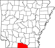
33°02′53″N 92°24′21″W / 33.04806°N 92.40583°W / 33.04806; -92.40583Aurelle is an unincorporated community in Union County, Arkansas, United States. Aurelle is located at the end of a paved road 5 miles (8.0 km) south-southwest of Strong.[2]
References
- ^ "Aurelle". Geographic Names Information System. United States Geological Survey, United States Department of the Interior.
- ^ Union County, Arkansas General Highway Map (PDF) (Map). Arkansas State Highway and Transportation Department. June 11, 2010. Archived from the original (PDF) on March 13, 2012.
- v
- t
- e
Municipalities and communities of Union County, Arkansas, United States
County seat: El Dorado
communities
- Arkansas portal
- United States portal
 | This article about a location in Union County, Arkansas is a stub. You can help Wikipedia by expanding it. |
- v
- t
- e


