Berlin Westhafen station
- Ringbahn (
 ,
,  )
) 
 : Bruno Grimmek
 : 28 August 1961; 62 years ago (1961-08-28)
 reopened: 19 December 1999; 24 years ago (1999-12-19)
 strike: 18 September 1980, officially 28 September 1980; 43 years ago (1980-09-28)
| Preceding station | Berlin S-Bahn | Following station | ||
|---|---|---|---|---|
| Beusselstraße One-way operation | S41 | Wedding Ringbahn (clockwise) | ||
| Beusselstraße Ringbahn (counter-clockwise) | S42 | Wedding One-way operation | ||
| Preceding station | Berlin U-Bahn | Following station | ||
| Birkenstraße towards Rathaus Steglitz | U9 | Amrumer Straße towards Osloer Straße | ||

Location | |
|---|---|
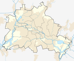
  Westhafen Location within Berlin |
Berlin Westhafen is a station in the Moabit district of Berlin. It is served by the S-Bahn lines S41 and S42 and the U-Bahn line U9.
Overview

The S-Bahn station was opened in 1898 under the name Putlitzstraße, which is the street on which the station lies. Despite sustaining damage during the Second World War, the station remained in service. The U-Bahn station was opened on 28 August 1961, soon after the building of the Berlin Wall and also with the name Putlitzstraße, although no direct interchange with the S-Bahn station existed. In 1980 the S-Bahn station lost its service owing to cessation of services on the Western part of the Ringbahn (circle line).
After the Wall fell, S-Bahn services were gradually reinstated. In 1992, the U-Bahn station was renamed Westhafen after the nearby Westhafen port and on its reopening on 19 December 1999, the S-Bahn station also assumed this name. Once one of the least-frequented U-Bahn stations on the network, the whole complex has now won a significance as an interchange between S-Bahn and U-Bahn. In the year 2000, the station was redesigned by artists Françoise Schein and Barbara Reiter: they installed the 1948 text of the Universal Declaration of Human Rights, juxtaposed with quotes of Heinrich Heine in German and French language.
References
- ^ "Der VBB-Tarif: Aufteilung des Verbundgebietes in Tarifwaben und Tarifbereiche" (PDF). Verkehrsbetrieb Potsdam. Verkehrsverbund Berlin-Brandenburg. 1 January 2017. Archived from the original (PDF) on 27 October 2020. Retrieved 25 November 2019.
External links

- Westhafen station artist project
- v
- t
- e
- Warschauer Straße
- Stralauer Tor (dismantled)
- Schlesisches Tor
- Görlitzer Bahnhof
- Kottbusser Tor
- Prinzenstraße
- Hallesches Tor
- Möckernbrücke
- Gleisdreieck
- Kurfürstenstraße
- Nollendorfplatz
- Wittenbergplatz
- Kurfürstendamm
- Uhlandstraße
- Pankow
- Vinetastraße
- Schönhauser Allee
- Eberswalder Straße
- Senefelderplatz
- Rosa-Luxemburg-Platz
- Alexanderplatz
- Klosterstraße
- Märkisches Museum
- Spittelmarkt
- Hausvogteiplatz
- Stadtmitte
- Mohrenstraße
- Potsdamer Platz
- Mendelssohn-Bartholdy-Park
- Gleisdreieck
- Bülowstraße
- Nollendorfplatz
- Wittenbergplatz
- Zoologischer Garten
- Ernst-Reuter-Platz
- Deutsche Oper
- Bismarckstraße
- Sophie-Charlotte-Platz
- Kaiserdamm
- Theodor-Heuss-Platz
- Neu-Westend
- Olympia-Stadion
- Ruhleben
- Warschauer Straße
- Stralauer Tor (dismantled)
- Schlesisches Tor
- Görlitzer Bahnhof
- Kottbusser Tor
- Prinzenstraße
- Hallesches Tor
- Möckernbrücke
- Gleisdreieck
- Kurfürstenstraße
- Nollendorfplatz
- Wittenbergplatz
- Augsburger Straße
- Nürnberger Platz (dismantled)
- Spichernstraße
- Hohenzollernplatz
- Fehrbelliner Platz
- Heidelberger Platz
- Rüdesheimer Platz
- Breitenbachplatz
- Podbielskiallee
- Dahlem-Dorf
- Freie Universität (Thielplatz)
- Oskar-Helene-Heim
- Onkel Toms Hütte
- Krumme Lanke
- Nollendorfplatz
- Viktoria-Luise-Platz
- Bayerischer Platz
- Rathaus Schöneberg
- Innsbrucker Platz
- Hauptbahnhof
- Bundestag
- Brandenburger Tor
- Unter den Linden
- Museumsinsel
- Rotes Rathaus
- Alexanderplatz
- Schillingstraße
- Strausberger Platz
- Weberwiese
- Frankfurter Tor
- Samariterstraße
- Frankfurter Allee
- Magdalenenstraße
- Lichtenberg
- Friedrichsfelde
- Tierpark
- Biesdorf-Süd
- Elsterwerdaer Platz
- Wuhletal
- Kaulsdorf Nord
- Kienberg (Gärten der Welt)
- Cottbusser Platz
- Hellersdorf
- Louis-Lewin-Straße
- Hönow
- Alt-Tegel
- Borsigwerke
- Holzhauser Straße
- Otisstraße
- Scharnweberstraße
- Kurt-Schumacher-Platz
- Afrikanische Straße
- Rehberge
- Seestraße
- Leopoldplatz
- Wedding
- Reinickendorfer Straße
- Schwartzkopffstraße
- Naturkundemuseum
- Oranienburger Tor
- Friedrichstraße
- Unter den Linden
- Französische Straße (closed)
- Stadtmitte
- Kochstraße
- Hallesches Tor
- Mehringdamm
- Platz der Luftbrücke
- Paradestraße
- Tempelhof
- Alt Tempelhof
- Kaiserin-Augusta-Straße
- Ullsteinstraße
- Westphalweg
- Alt-Mariendorf
- Rathaus Spandau
- Altstadt Spandau
- Zitadelle
- Haselhorst
- Paulsternstraße
- Rohrdamm
- Siemensdamm
- Halemweg
- Jakob-Kaiser-Platz
- Jungfernheide
- Mierendorffplatz
- Richard-Wagner-Platz
- Bismarckstraße
- Wilmersdorfer Straße
- Adenauerplatz
- Konstanzer Straße
- Fehrbelliner Platz
- Blissestraße
- Berliner Straße
- Bayerischer Platz
- Eisenacher Straße
- Kleistpark
- Yorckstraße
- Möckernbrücke
- Mehringdamm
- Gneisenaustraße
- Südstern
- Hermannplatz
- Rathaus Neukölln
- Karl-Marx-Straße
- Neukölln
- Grenzallee
- Blaschkoallee
- Parchimer Allee
- Britz-Süd
- Johannisthaller Chaussee
- Lipschitzallee
- Wutzkyallee
- Zwickauer Damm
- Rudow
- Wittenau
- Rathaus Reinickendorf
- Karl-Bonhoeffer-Nervenklinik
- Lindauer Allee
- Paracelsus-Bad
- Residenzstraße
- Franz-Neumann-Platz
- Osloer Straße
- Pankstraße
- Gesundbrunnen
- Voltastraße
- Bernauer Straße
- Rosenthaler Platz
- Weinmeisterstraße
- Alexanderplatz
- Jannowitzbrücke
- Heinrich-Heine-Straße
- Moritzplatz
- Kottbusser Tor
- Schönleinstraße
- Hermannplatz
- Boddinstraße
- Leinestraße
- Hermannstraße
- Osloer Straße
- Nauener Platz
- Leopoldplatz
- Amrumer Straße
- Westhafen
- Birkenstraße
- Turmstraße
- Hansaplatz
- Zoologischer Garten
- Kurfürstendamm
- Spichernstraße
- Güntzelstraße
- Berliner Straße
- Bundesplatz
- Friedrich-Wilhelm-Platz
- Walther-Schreiber-Platz
- Schloßstraße
- Rathaus Steglitz
52°32′10″N 13°20′38″E / 52.536°N 13.344°E / 52.536; 13.344


