Birkenhördt
You can help expand this article with text translated from the corresponding article in German. (June 2015) Click [show] for important translation instructions.
- View a machine-translated version of the German article.
- Machine translation, like DeepL or Google Translate, is a useful starting point for translations, but translators must revise errors as necessary and confirm that the translation is accurate, rather than simply copy-pasting machine-translated text into the English Wikipedia.
- Do not translate text that appears unreliable or low-quality. If possible, verify the text with references provided in the foreign-language article.
- You must provide copyright attribution in the edit summary accompanying your translation by providing an interlanguage link to the source of your translation. A model attribution edit summary is
Content in this edit is translated from the existing German Wikipedia article at [[:de:Birkenhördt]]; see its history for attribution. - You may also add the template
{{Translated|de|Birkenhördt}}to the talk page. - For more guidance, see Wikipedia:Translation.
Municipality in Rhineland-Palatinate, Germany

Coat of arms
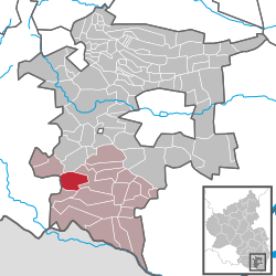
Location of Birkenhördt within Südliche Weinstraße district
(2022-12-31)[2]
76889

Birkenhördt is a municipality in the Südliche Weinstraße district, in Rhineland-Palatinate, Germany, and is an officially recognized tourist resort.[3]
Geography
Birkenhördt lies in the Wasgau, which is composed of the southern part of the Palatine Forest and the northern part of the Vosges Mountains.
Neighboring municipalities are - clockwise - Silz, Bad Bergzabern, Dörrenbach, Böllenborn, Erlenbach bei Dahn, and Vorderweidenthal.
The source of the Erlenbach is located in Birkenhördt.
History
In the 1930s Birkenhördt was annexed to the district of Bad Bergzabern. With the local-government reform in Rhineland-Palatinate in 1969 Birkenhördt, along with most communities of the district was incorporated into the newly created district Landau-Bad Bergzabern. This in turn was renamed in 1978 as the Südliche Weinstraße district.
Coat of arms
The coat of arms shows a golden lion on a black field symbolizing Birkenhördt's one-time allegiance to the Palatinate, and a green birch branch as a visual pun on the name "Birkenhördt". They might be heraldically described "Party per bend sinister, sable a lion passant bendwise sinister or crowned armed and langued gules, or a three-leaved birch branch vert."
Culture and sightseeing

There are a total of six cultural monuments in the municipality, including the 1862 parish church of Saint Gall.
Transportation
Bundesstraße (Federal Highway) 427 runs through the middle of the town. Birkenhördt is connected by the bus lines to the local transport network. The nearest railway station is located at Bad Bergzabern.
References
- ^ Direktwahlen 2019, Landkreis Südliche Weinstraße, Landeswahlleiter Rheinland-Pfalz, accessed 10 August 2021.
- ^ "Bevölkerungsstand 2022, Kreise, Gemeinden, Verbandsgemeinden" (PDF) (in German). Statistisches Landesamt Rheinland-Pfalz. 2023.
- ^ Statistisches Landesamt Rheinland-Pfalz – Regionaldaten
External links
- Birkenhördt official site(in German)
- The Birkenhördt Project – Genealogy in the Southern Palatinate
- v
- t
- e
Towns and municipalities in Südliche Weinstraße
- Albersweiler
- Altdorf
- Annweiler am Trifels
- Bad Bergzabern
- Barbelroth
- Billigheim-Ingenheim
- Birkenhördt
- Birkweiler
- Böbingen
- Böchingen
- Böllenborn
- Bornheim
- Burrweiler
- Dernbach
- Dierbach
- Dörrenbach
- Edenkoben
- Edesheim
- Eschbach
- Essingen
- Eußerthal
- Flemlingen
- Frankweiler
- Freimersheim
- Gleisweiler
- Gleiszellen-Gleishorbach
- Göcklingen
- Gommersheim
- Gossersweiler-Stein
- Großfischlingen
- Hainfeld
- Hergersweiler
- Herxheim
- Herxheimweyher
- Heuchelheim-Klingen
- Hochstadt
- Ilbesheim bei Landau in der Pfalz
- Impflingen
- Insheim
- Kapellen-Drusweiler
- Kapsweyer
- Kirrweiler
- Kleinfischlingen
- Klingenmünster
- Knöringen
- Leinsweiler
- Maikammer
- Münchweiler am Klingbach
- Niederhorbach
- Niederotterbach
- Oberhausen
- Oberotterbach
- Oberschlettenbach
- Offenbach an der Queich
- Pleisweiler-Oberhofen
- Ramberg
- Ranschbach
- Rhodt unter Rietburg
- Rinnthal
- Rohrbach
- Roschbach
- Sankt Martin
- Schweigen-Rechtenbach
- Schweighofen
- Siebeldingen
- Silz
- Steinfeld
- Venningen
- Völkersweiler
- Vorderweidenthal
- Waldhambach
- Waldrohrbach
- Walsheim
- Wernersberg
- Weyher in der Pfalz

Authority control databases | |
|---|---|
| International |
|
| National |
|


