Bogale Township
Township in Ayeyarwady Region, Burma
Bogale Township ဘိုကလေးမြို့နယ် Bogalay Township | |
|---|---|
Township | |
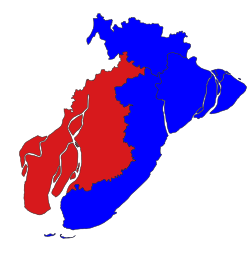 Location in Pyapon district | |
| 16°05′N 95°24′E / 16.083°N 95.400°E / 16.083; 95.400 | |
| Country |  Burma Burma |
| Region | Ayeyarwady Region |
| District | Pyapon District |
| Administrative seat | Bogale |
| Population (December 2008)[1] | 349,427 |
| Time zone | UTC+6:30 (MST) |
Bogale Township (Burmese: ဘိုကလေးမြို့နယ် [bòɡəlé mjo̰nɛ̀]) is a township of Pyapon District in the Ayeyarwady Region of Burma (Myanmar).
In May 2008, the town of Bogale suffered heavily from Cyclone Nargis; 36,325 people were listed as dead or missing.[1]
Communities
On 8 August 2008, two village tracts (Kadonkani and Ayeyar) from Pyapon Township were moved into Bogale Township.[1] As of March 2009[update], there were 71 village tracts comprising 589 villages in Bogale Township.[1] Additional boundary adjustments were made on 5 August 2009.[1]
Notes
- ^ a b c d e "Bogale Township Profile"[permanent dead link] Myanmar Information Management Unit (MIMU) March 2009
External links
- "Bogale Township, Ayeyarwady Division"[permanent dead link] map ID: MIMU154v02, created: 1 July 2010, Myanmar Information Management Unit (MIMU)
- "Bogale Google Satellite Map" Maplandia World Gazetteer
- v
- t
- e
Ayeyarwady Region
Capital: Pathein


- Kyaunggon Township
- Kyonpyaw Township
- Yekyi Township (Ngathinechaung Subtownship)
- Labutta Township (Pyinsalu Subtownship)
- Mawlamyinegyun Township
- Bogale Township
- Dedaye Township
- Kyaiklat Township
- Pyapon Township (Ahmar Subtownship)
- Pathein
- Ahmar
- Ahtaung
- Aingthapyu
- Bogale
- Chaungtha
- Danubyu
- Dedaye
- Einme
- Hainggyi Island
- Hinthada
- Ingapu
- Kanaung
- Kangyidaut
- Kyaiklat
- Kyangin
- Kyaunggon
- Kyonmanage
- Kyonpyaw
- Labutta
- Lemyethna
- Maubin
- Mawlamyinegyun
- Myan Aung
- Myaungmya
- Ngapudaw
- Ngathaingchaung
- Ngayokaung
- Ngwesaung
- Nyaungdon
- Pantanaw
- Pyapon
- Pyinsalu
- Shwelaung
- Thabaung
- Wakema
- Yekyi
- Zalun
  | This Ayeyarwady Region location article is a stub. You can help Wikipedia by expanding it. |
- v
- t
- e


