Costa Marques
Municipality in North, Brazil

Flag

Coat of arms
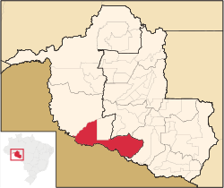
Location in Rondônia state
(2020 [1])
Costa Marques is a municipality located in the Brazilian state of Rondônia. Its population was 18,798 (2020) and its area is 4,987 km2.[2]
The city is located in the Guaporé River's right bank and the main attraction is Forte Príncipe da Beira (named after the Prince of Beira), which was built in 1786 by the Portuguese Kingdom to protect that region from the Spanish Crown.
The municipality contains 91% of the 36,442 hectares (90,050 acres) Serra dos Reis State Park.[3] It contains 14% of the 2,244 hectares (5,550 acres) Serra dos Reis A State Park, created in 1996.[4] It also contains 52.5% of the 146,400 hectares (362,000 acres) Rio Cautário State Extractive Reserve, created in 1995.[5]
References
- ^ IBGE 2020
- ^ IBGE - [1]
- ^ PES Serra dos Reis (in Portuguese), ISA: Instituto Socioambiental, retrieved 2016-08-06
- ^ PES Serra dos Reis A (in Portuguese), ISA: Instituto Socioambiental, retrieved 2016-12-20
- ^ RESEX Rio Cautário (Estadual) (in Portuguese), ISA: Instituto Socioambiental, retrieved 2016-09-15
- v
- t
- e

Capital: Porto Velho
| Ariquemes | |
|---|---|
| Jaru | |
| Porto Velho |

| Cacoal | |
|---|---|
| Ji-Paraná |
|
| Vilhena |
| Authority control databases |
|
|---|
 | This Rondônia, Brazil location article is a stub. You can help Wikipedia by expanding it. |
- v
- t
- e


