Forestdale, London
Human settlement in England
- London
- Croydon Central
- Croydon and Sutton
Forestdale is a residential neighbourhood of southeast London in the London Borough of Croydon. It is sometimes considered to be part of Addington, its ancient and ecclesiastical parish.[1] It is located south of Upper Shirley, east of Selsdon, south-west of Addington's historic centre, north-west of New Addington and north of Farleigh and is east of West Wickham.
Geography
Forestdale has public green verges and a nature reserve with diverse walks. Adjoining are Addington and Croydon's closest golf courses. Forestdale is linked to Croydon via Addington by Featherbed Lane and is also linked towards Croydon or Orpington via West Wickham which skirts the suburb on one side.
The suburb consists of cul-de-sacs running off four main roads, the cul-de-sacs being subdivided into several 'neighbourhoods'. All houses within a cul-de-sac are of the same style, but differ from other cul-de-sacs in style and materials, such as weatherboarding, brick colour and arrangement, and so uniformity of style is achieved within one cul-de-sac but differs from the others.
Forestdale contains a community centre (The Forum) on Pixton Way.[1] There is a small row of shops at the junction of Featherbed Lane and Selsdon Park Road, which contains a pub (The Forestdale Arms).[1] The fish & chip shop here (McDermott's) was voted the best in London and the South-East in 2005.[1]
History
Most homes were built here between the late 1960s and mid 1970s on previously open ground containing a number of smallholdings.[1] Wates Group, a construction firm heavily involved in many of the homes' construction, won an award in 1972 due to the solar heating panels they installed in three of the houses.[2][1]
Transport
Two London Buses serve the village; routes 353 and 433
All parts of Forestdale are within a mile of Tramlink tram stops:
- Fieldway
- Addington
- Gravel Hill, which is also connected via the buses.
Nearest Stations
All parts of Forestdale are within a mile of these following National Railway Stations:
- West Wickham railway station located two miles east of Forestdale which is connected by bus routes that serve the Forestdale area.
- South Croydon located three miles north of Forestdale.
- Sanderstead railway station located three miles south west of Forestdale.
Education
Primary Education
- Courtwood Primary School
- Forestdale Primary School
Notable people
- Rachel Chinouriri, singer[3]
Gallery
-
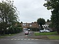
 Shops on Selsdon Park Road
 -
 The Forum
 -
 The Forestdale Arms pub
 -
 Forestdale Shopping Centre
 -
 Forestdale Primary School
 -
 Typical housing in Forestdale


References
- ^ a b c d e f Willey, Russ (2006). The London Gazzetteer. Chambers Harrap Publishers Ltd. p. 180-81.
- ^ "Wates Built House". Archived from the original on 20 August 2009. Retrieved 6 June 2009. Copper Development Association First Prize for solar heating
- ^ Rigotti, Alex (15 January 2024). "Rachel Chinouriri has finally come home". NME. Archived from the original on 16 January 2024. Retrieved 16 January 2024.
- v
- t
- e
- Addington
- Addiscombe
- Beddington
- Broad Green
- Coombe
- Coulsdon
- Croydon
- Crystal Palace
- Forestdale
- Hamsey Green
- Kenley
- Monks Orchard
- New Addington
- Norbury
- Norwood New Town
- Old Coulsdon
- Old Town
- Pollards Hill
- Purley
- Russell Hill
- Sanderstead
- Selhurst
- Selsdon
- Shirley (Including Shirley Oaks and Upper Shirley)
- South Croydon
- South Norwood
- Spring Park
- Thornton Heath
- Upper Norwood
- Waddon
- Woodcote
- Woodside
- Whyteleafe


open spaces
- Addington Hills
- Addington Park
- Addington Vale
- Addiscombe Railway Park
- Addiscombe Recreation Ground
- Apsley Road Playground
- Ashburton Park
- Ashburton Playing Fields
- Beaulieu Heights
- Bramley Bank
- Brickfields Meadow
- Coombe Wood
- Cotelands
- Croham Hurst
- Duppas Hill
- Farthing Downs
- Foxley Wood
- Grangewood Park
- Great North Wood
- Happy Valley Park
- Heathfield House
- Heavers Meadow
- Hutchinson's Bank
- Kenley Common
- Littleheath Woods
- Lloyd Park
- Mitcham Common
- Norwood Grove
- Park Hill
- Pollards Hill
- Queen's Gardens
- Riddlesdown Common
- Roundshaw
- Selsdon Wood
- South Norwood Country Park
- South Norwood Lake and Grounds
- South Norwood Recreation Ground
- Spa Wood
- Wandle Park
- Woodside Green
- Croydon South
- Croydon Central
- Croydon North
- Addiscombe East
- Addiscombe West
- Bensham Manor
- Broad Green
- Coulsdon Town
- Crystal Palace & Upper Norwood
- Fairfield
- Kenley
- New Addington North
- New Addington South
- Norbury & Pollards Hill
- Norbury Park
- Old Coulsdon
- Park Hill & Whitgift
- Purley & Woodcote
- Purley Oaks & Riddlesdown
- Sanderstead
- Selhurst
- Selsdon & Addington Village
- Selsdon Vale & Forestdale
- Shirley North
- Shirley South
- South Croydon
- South Norwood
- Thornton Heath
- Waddon
- West Thornton
- Woodside
and tram stops
- Addington Village
- Addiscombe
- Ampere Way
- Arena
- Blackhorse Lane
- Centrale
- Church Street
- Coombe Lane
- Coulsdon South
- Coulsdon Town
- East Croydon
- Fieldway
- George Street
- Gravel Hill
- Harrington Road
- Kenley
- King Henry's Drive
- Lebanon Road
- Lloyd Park
- New Addington
- Norbury
- Norwood Junction
- Purley Oaks
- Purley
- Reedham
- Reeves Corner
- Riddlesdown
- Sanderstead
- Sandilands
- Selhurst
- South Croydon
- Thornton Heath
- Waddon
- Waddon Marsh
- Wandle Park
- Wellesley Road
- West Croydon
- Woodmansterne
- Woodside
 Category
 Commons


