Gowensville, South Carolina
Unincorporated community in South Carolina, US
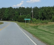
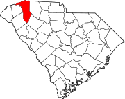
Gowensville is an unincorporated community in Greenville County, South Carolina, United States.[1] The community sits along the Cherokee Foothills Scenic Highway and South Carolina Highway 14, flanking the Spartanburg County border to its east.
History
In 1780, during the American Revolutionary War, a skirmish between Loyalist and Patriot forces occurred at Gowen's Fort, named for soldier John "Buck" Gowen, the namesake of the town of Gowensville.[2] A band of Loyalists and Chickamauga Cherokee, commanded by Captain William Bates, approached the area in an attempt to siege the Patriot stronghold. Despite their strong resistance, Patriot forces succumbed to a lack of ammunition and were forced to surrender. Bates initially promised to protect those within the fort from the Indian fighters, but upon their exit, Bates gave the command for all of his soldiers to kill the resistance. The number of deceased is unknown.[3]
Gowensville is home to Campbell's Covered Bridge, the last covered bridge in the state of South Carolina.[4] The locale is considered part of the informal region known as the "Dark Corner", which represented a safe haven for political dissenters and moonshiners in South Carolina throughout the 1800s.[5]
References
- ^ "Gowensville". Geographic Names Information System. United States Geological Survey, United States Department of the Interior. Retrieved October 7, 2022.
- ^ "Cherokee Foothills Historical Marker". www.hmdb.org. Retrieved September 27, 2022.
- ^ "The American Revolution in South Carolina - Gowen's Fort". www.carolana.com. Retrieved September 27, 2022.
- ^ "Gowensville And Campbell's Covered Bridge". discoversouthcarolina.com. Retrieved September 27, 2022.
- ^ "A trip to the Dark Corner of South Carolina". GVLtoday. May 28, 2020. Retrieved September 27, 2022.
External links
- Gowensville Community Website
- v
- t
- e
Municipalities and communities of Greenville County, South Carolina, United States
County seat: Greenville
- Fountain Inn‡
- Greenville
- Greer‡
- Mauldin
- Simpsonville
- Travelers Rest
communities
- Batesville
- Cleveland
- Gowensville
‡This populated place also has portions in an adjacent county or counties
- South Carolina portal
- United States portal
35°06′53″N 82°13′30″W / 35.11472°N 82.22500°W / 35.11472; -82.22500


