Kestilä
Place in Northern Ostrobothnia, Finland

Coat of arms
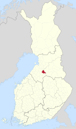
Location of Kestilä in Finland
(2015-12-31)[2]
Kestilä is a village and former municipality of Finland. It is located in the province of Oulu and is part of the Northern Ostrobothnia region.
Established in 1867, the population was 536 as of 31 December 2015.[2] The municipality covered an area of 606.53 km2 (234.18 sq mi) of which 5.09 km2 (1.97 sq mi) is water.[1]
The municipality was unilingually Finnish.
The municipality was consolidated with Piippola, Pulkkila and Rantsila on 2009-01-01 to form a new municipality of Siikalatva.[3]
References
- ^ a b "Area by municipality as of 1 January 2008" (PDF) (in Finnish and Swedish). Land Survey of Finland. Retrieved 27 March 2010.[permanent dead link]
- ^ a b "Taajamat väkiluvun ja väestöntiheyden mukaan 31 December 2015". Population Information System (in Finnish and Swedish). Population Register Center of Finland. Retrieved 6 May 2017.
- ^ "Pohjois-Pohjanmaalle tulee uusi Siikalatvan kunta". YLE Uutiset (YLE News) (in Finnish). Yleisradio Oy. 2008-02-25. Retrieved 2008-08-03.
External links
![]() Media related to Kestilä at Wikimedia Commons
Media related to Kestilä at Wikimedia Commons ![]() Kestilä travel guide from Wikivoyage
Kestilä travel guide from Wikivoyage
- Municipality of Kestilä – official site
- v
- t
- e

| Authority control databases: National |
|
|---|
 | This Oulu Province location article is a stub. You can help Wikipedia by expanding it. |
- v
- t
- e


