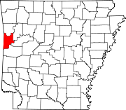
List of lakes of Sebastian County, Arkansas
Map all coordinates using OpenStreetMap
Download coordinates as:
- KML
- GPX (all coordinates)
- GPX (primary coordinates)
- GPX (secondary coordinates)
There are at least 25 named lakes and reservoirs in Sebastian County, Arkansas.
Lakes
- Courthouse Slough, 35°25′10″N 094°07′41″W / 35.41944°N 94.12806°W / 35.41944; -94.12806 (Courthouse Slough), el. 394 feet (120 m) [1]
- Greenwood Lake, 35°11′16″N 094°14′42″W / 35.18778°N 94.24500°W / 35.18778; -94.24500 (Greenwood Lake), el. 522 feet (159 m) [2]
- Lake Spur, 35°01′10″N 094°14′24″W / 35.01944°N 94.24000°W / 35.01944; -94.24000 (Lake Spur), el. 709 feet (216 m) [3]
- Sugar Loaf Lake, 35°05′32″N 094°24′25″W / 35.09222°N 94.40694°W / 35.09222; -94.40694 (Sugar Loaf Lake), el. 643 feet (196 m) [4]
Reservoirs
- Bailey Hill Reservoir, 35°21′51″N 094°25′04″W / 35.36417°N 94.41778°W / 35.36417; -94.41778 (Bailey Hill Reservoir), el. 564 feet (172 m) [5]
- Booneville Lake, 35°08′52″N 094°03′36″W / 35.14778°N 94.06000°W / 35.14778; -94.06000 (Booneville Lake), el. 535 feet (163 m) [6]
- Crain Lake, 35°23′00″N 094°21′49″W / 35.38333°N 94.36361°W / 35.38333; -94.36361 (Crain Lake), el. 436 feet (133 m) [7]
- Crouch Lake, 35°18′46″N 094°09′11″W / 35.31278°N 94.15306°W / 35.31278; -94.15306 (Crouch Lake), el. 453 feet (138 m) [8]
- Crowe Hill Reservoir, 35°20′48″N 094°23′45″W / 35.34667°N 94.39583°W / 35.34667; -94.39583 (Crowe Hill Reservoir), el. 705 feet (215 m) [9]
- Echols Lake, 35°21′30″N 094°23′14″W / 35.35833°N 94.38722°W / 35.35833; -94.38722 (Echols Lake), el. 574 feet (175 m) [10]
- Engineer Lake, 35°16′47″N 094°06′58″W / 35.27972°N 94.11611°W / 35.27972; -94.11611 (Engineer Lake), el. 440 feet (130 m) [11]
- Gurisco Lake, 35°15′58″N 094°26′00″W / 35.26611°N 94.43333°W / 35.26611; -94.43333 (Gurisco Lake), el. 466 feet (142 m) [12]
- Lake Number One, 35°01′29″N 094°16′07″W / 35.02472°N 94.26861°W / 35.02472; -94.26861 (Lake Number One), el. 656 feet (200 m) [13]
- Lake Number Two, 35°00′54″N 094°16′55″W / 35.01500°N 94.28194°W / 35.01500; -94.28194 (Lake Number Two), el. 676 feet (206 m) [14]
- Mansfield Lake, 35°03′30″N 094°14′07″W / 35.05833°N 94.23528°W / 35.05833; -94.23528 (Mansfield Lake), el. 636 feet (194 m) [15]
- McMahan Lake, 35°19′41″N 094°18′02″W / 35.32806°N 94.30056°W / 35.32806; -94.30056 (McMahan Lake), el. 446 feet (136 m) [16]
- Number Name Lake, 35°21′30″N 094°07′33″W / 35.35833°N 94.12583°W / 35.35833; -94.12583 (Number Name Lake), el. 417 feet (127 m) [17]
- Park Lake, 35°00′54″N 094°15′31″W / 35.01500°N 94.25861°W / 35.01500; -94.25861 (Park Lake), el. 732 feet (223 m) [18]
- Pool 13, 35°21′00″N 094°17′31″W / 35.35000°N 94.29194°W / 35.35000; -94.29194 (Pool 13), el. 387 feet (118 m) [19]
- Sebastian Lake, 35°12′55″N 094°24′17″W / 35.21528°N 94.40472°W / 35.21528; -94.40472 (Sebastian Lake), el. 604 feet (184 m) [20]
- Shadow Lake, 35°13′57″N 094°17′59″W / 35.23250°N 94.29972°W / 35.23250; -94.29972 (Shadow Lake), el. 653 feet (199 m) [21]
- Wildcat Mountain Lake, 35°22′01″N 094°20′56″W / 35.36694°N 94.34889°W / 35.36694; -94.34889 (Wildcat Mountain Lake), el. 436 feet (133 m) [22]
- Williamson Lake, 35°14′16″N 094°17′09″W / 35.23778°N 94.28583°W / 35.23778; -94.28583 (Williamson Lake), el. 587 feet (179 m) [23]
- Willies Lake, 35°18′17″N 094°20′12″W / 35.30472°N 94.33667°W / 35.30472; -94.33667 (Willies Lake), el. 495 feet (151 m) [24]
- Wofford Lake, 35°13′20″N 094°26′03″W / 35.22222°N 94.43417°W / 35.22222; -94.43417 (Wofford Lake), el. 548 feet (167 m) [25]
See also
Notes
- ^ "Courthouse Slough". Geographic Names Information System. United States Geological Survey, United States Department of the Interior.
- ^ "Greenwood Lake". Geographic Names Information System. United States Geological Survey, United States Department of the Interior.
- ^ "Lake Spur". Geographic Names Information System. United States Geological Survey, United States Department of the Interior.
- ^ "Sugar Loaf Lake". Geographic Names Information System. United States Geological Survey, United States Department of the Interior.
- ^ "Bailey Hill Reservoir". Geographic Names Information System. United States Geological Survey, United States Department of the Interior.
- ^ "Booneville Lake". Geographic Names Information System. United States Geological Survey, United States Department of the Interior.
- ^ "Crain Lake". Geographic Names Information System. United States Geological Survey, United States Department of the Interior.
- ^ "Crouch Lake". Geographic Names Information System. United States Geological Survey, United States Department of the Interior.
- ^ "Crowe Hill Reservoir". Geographic Names Information System. United States Geological Survey, United States Department of the Interior.
- ^ "Echols Lake". Geographic Names Information System. United States Geological Survey, United States Department of the Interior.
- ^ "Engineer Lake". Geographic Names Information System. United States Geological Survey, United States Department of the Interior.
- ^ "Gurisco Lake". Geographic Names Information System. United States Geological Survey, United States Department of the Interior.
- ^ "Lake Number One". Geographic Names Information System. United States Geological Survey, United States Department of the Interior.
- ^ "Lake Number Two". Geographic Names Information System. United States Geological Survey, United States Department of the Interior.
- ^ "Mansfield Lake". Geographic Names Information System. United States Geological Survey, United States Department of the Interior.
- ^ "McMahan Lake". Geographic Names Information System. United States Geological Survey, United States Department of the Interior.
- ^ "Number Name Lake". Geographic Names Information System. United States Geological Survey, United States Department of the Interior.
- ^ "Park Lake". Geographic Names Information System. United States Geological Survey, United States Department of the Interior.
- ^ "Pool 13". Geographic Names Information System. United States Geological Survey, United States Department of the Interior.
- ^ "Sebastian Lake". Geographic Names Information System. United States Geological Survey, United States Department of the Interior.
- ^ "Shadow Lake". Geographic Names Information System. United States Geological Survey, United States Department of the Interior.
- ^ "Wildcat Mountain Lake". Geographic Names Information System. United States Geological Survey, United States Department of the Interior.
- ^ "Williamson Lake". Geographic Names Information System. United States Geological Survey, United States Department of the Interior.
- ^ "Willies Lake". Geographic Names Information System. United States Geological Survey, United States Department of the Interior.
- ^ "Wofford Lake". Geographic Names Information System. United States Geological Survey, United States Department of the Interior.
- v
- t
- e
Municipalities and communities of Sebastian County, Arkansas, United States
County seats: Fort Smith and Greenwood
communities
‡This populated place also has portions in an adjacent county or counties
- Arkansas portal
- United States portal


