Masonville, Colorado
Unincorporated community in Colorado, United States
40°29′14″N 105°12′36″W / 40.48722°N 105.21000°W / 40.48722; -105.21000 United States
 Colorado
80541
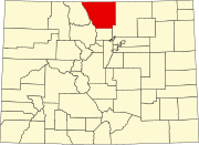
Masonville is an unincorporated community and a U.S. Post Office in Larimer County, Colorado, United States. The Masonville Post Office has the ZIP Code 80541.[2]
Geography
Masonville is located at 40°29′14″N 105°12′36″W / 40.48722°N 105.21000°W / 40.48722; -105.21000 (40.487171,-105.210056).
References
- ^ a b "US Board on Geographic Names". United States Geological Survey. October 25, 2007. Retrieved January 31, 2008.
- ^ a b "ZIP Code Lookup". United States Postal Service. January 2, 2007. Archived from the original (JavaScript/HTML) on November 22, 2010. Retrieved January 2, 2007.
- v
- t
- e
Municipalities and communities of Larimer County, Colorado, United States
County seat: Fort Collins
communities
‡This populated place also has portions in an adjacent county or counties
- Colorado portal
- United States portal


