Nong Yai district
District in Chonburi, Thailand
Nong Yai หนองใหญ่ | |
|---|---|
District | |
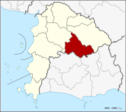 District location in Chonburi province | |
| Coordinates: 13°9′24″N 101°22′0″E / 13.15667°N 101.36667°E / 13.15667; 101.36667 | |
| Country | Thailand |
| Province | Chonburi |
| Seat | Nong Yai |
| Tambon | 5 |
| Area | |
| • Total | 397.5 km2 (153.5 sq mi) |
| Population (2015) | |
| • Total | 23,609 |
| • Density | 59.39/km2 (153.8/sq mi) |
| Time zone | UTC+7 (ICT) |
| Postal code | 20190 |
| Geocode | 2003 |
Nong Yai (Thai: หนองใหญ่, pronounced [nɔ̌ːŋ jàj]) is a district (amphoe) in the province Chonburi, Thailand.
History
The minor district (king amphoe) Nong Yai was created on 1 December 1975. The three tambons, Nong Yai, Khlong Phlu, and Nong Suea Chang were split off from Ban Bueng district.[1] It was upgraded to a full district on 13 July 1981.[2]
Geography
Neighboring districts are (from the south clockwise) Wang Chan and Pluak Daeng of Rayong province, Si Racha, Ban Bueng and Bo Thong of Chonburi Province.
Administration
The district is divided into five sub-districts (tambons), which are further subdivided into 24 villages (mubans). Nong Yai is a township (thesaban tambon) which covers the whole tambon Nong Yai. There are a further four tambon administrative organizations (TAO).
| No. | Name | Thai name | Villages | Pop. | |
|---|---|---|---|---|---|
| 1. | Nong Yai | หนองใหญ่ | 6 | 7,530 | |
| 2. | Khlong Phlu | คลองพลู | 4 | 3,645 | |
| 3. | Nong Suea Chang | หนองเสือช้าง | 5 | 4,106 | |
| 4. | Hang Sung | ห้างสูง | 5 | 3,333 | |
| 5. | Khao Sok | เขาซก | 4 | 3,370 |
References
- ^ ประกาศกระทรวงมหาดไทย เรื่อง แบ่งท้องที่อำเภอบ้านบึง จังหวัดชลบุรี ตั้งเป็นกิ่งอำเภอหนองใหญ่ (PDF). Royal Gazette (in Thai). 92 (245 ง): 3062. December 1, 1975. Archived from the original (PDF) on September 30, 2007.
- ^ พระราชกฤษฎีกาตั้งอำเภอหนองใหญ่ อำเภอบ่อไร่ อำเภอพรหมคีรี อำเภอนาบอน อำเภอบางสะพานน้อย อำเภอนาดี อำเภอกงหรา อำเภอวังทรายพูน อำเภอธารโต อำเภอคำตากล้า อำเภอศรีนคร อำเภอด่านช้าง อำเภอพรเจริญ อำเภอวังสามหมอ และอำเภอลานสัก พ.ศ. ๒๕๒๔ (PDF). Royal Gazette (in Thai). 98 (115 ก Special): 7–10. July 13, 1981. Archived from the original (PDF) on September 30, 2007.
External links
- amphoe.com
- v
- t
- e
Chonburi (capital)
- 20th World Scout Jamboree
- 21st Infantry Regiment
- Ban Phlu Ta Luang railway station
- Bang Saen Beach
- Burapha University
- Chak Ngaeo
- Chonburi F.C.
- Chon Buri railway station
- Jomtien Beach
- Mountain B nightclub fire
- Pattaya railway station
- Pattaya Utd
- Phalang Chon Party
- Phra Chuthathut Palace
- Royal Thai Marine Corps (RTMC)
- Sanctuary of Truth
- Si Racha Junction railway station
- Sriracha F.C.
- Sriracha Tiger Zoo
- Sukhumvit Road (Highway 3)
- Nong Nooch Garden
- Khao Chi Chan Junction railway station
- Khao Khiao Massif
- Khao Kheow Open Zoo
- Khao Sam Muk
- Ko Lan
- Wat Saen Suk
 | This Chonburi Province location article is a stub. You can help Wikipedia by expanding it. |
- v
- t
- e


