Norristown Farm Park
40°08′01″N 75°21′02″W / 40.13361°N 75.35056°W / 40.13361; -75.35056
Norristown Farm Park is a 690-acre (279 ha) Pennsylvania state park in East Norriton and West Norriton Townships and Norristown in Montgomery County, Pennsylvania, in the United States.[2] Located just off of Interstate 276 on West Germantown Pike,[3] it is operated in partnership with the Montgomery County Department of Parks.
A working farm on the site of Norristown State Hospital, the park has multiple colonial-era farm buildings and homes on its grounds.[3]
Stony Creek flows through the park. Baseball, bicycling, cross-country skiing, hiking, fishing, and picnicking opportunities are available in the park, as are summer musical concerts.[3]
History
Norristown Farm Park was originally part of a 7,000-acre (2,800 ha) tract of land called "Williamstadt," which originally belonged to William Penn.[4] The property was then transferred to Isaac Norris, the namesake of Norristown, by way of Penn's son, William Penn, Jr. Norris's heirs sold pieces of Williamstadt to the Commonwealth of Pennsylvania and Norristown State Hospital was opened in the 1870s as a mental hospital.[5] The park is on state-owned land that surrounds the hospital.[5]
Gallery
-
 Park Sign in dim light
 -
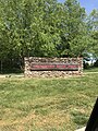 Same Park Sign in brighter light
 -
 Germantown Pike Entrance
 -
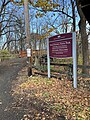 Stanbridge Street Entrance


Nearby state parks
The following state parks are within 30 miles (48 km) of Norristown Farm Park:[6][7][8]
- Benjamin Rush State Park (Philadelphia County)
- Bull's Island Recreation Area (New Jersey)
- Evansburg State Park (Montgomery County)
- Delaware Canal State Park (Bucks and Northampton Counties)
- Delaware and Raritan Canal State Park (New Jersey)
- French Creek State Park (Berks and Chester Counties)
- Fort Washington State Park (Montgomery County)
- Fox Point State Park (Delaware)
- Neshaminy State Park (Bucks County)
- Nockamixon State Park (Bucks County)
- Marsh Creek State Park (Chester County)
- Ralph Stover State Park (Bucks County)
- Rancocas State Park (New Jersey)
- Ridley Creek State Park (Delaware County)
- Tyler State Park (Bucks County)
- Washington Crossing State Park (New Jersey)
References
- ^ "Norristown Farm Park". Geographic Names Information System. United States Geological Survey. August 23, 2007. Retrieved June 18, 2008.
- ^ "Norristown Farm State Park". Pennsylvania Department of Conservation and Natural Resources. Archived from the original on October 10, 2011. Retrieved December 12, 2006.
- ^ a b c "Norristown Farm Park Montgomery County page". County of Montgomery, PA. Archived from the original on February 20, 2007. Retrieved December 12, 2006.
- ^ "Norristown Farm Park Schuylkill River National and State Heritage Area". Schuylkill River Greenway Association. Retrieved December 12, 2006.
- ^ a b Reverend Judith A. Meier. "An Historic District Within the Boundaries of the Norristown State Hospital". Farm Park Preservation Association. Archived from the original on August 11, 2006. Retrieved January 22, 2007.
- ^ "Find a Park by Region (interactive map)". Pennsylvania Department of Conservation and Natural Resources. Archived from the original on September 24, 2011. Retrieved November 18, 2011.
- ^ Michels, Chris (1997). "Latitude/Longitude Distance Calculation". Northern Arizona University. Retrieved April 23, 2008.
- ^ "2007 General Highway Map Montgomery County Pennsylvania" (PDF) (Map). 1:65,000. Pennsylvania Department of Transportation, Bureau of Planning and Research, Geographic Information Division. Retrieved July 27, 2007.[permanent dead link] Note: shows Norristown Farm Park
External links
 Pennsylvania portal

Wikimedia Commons has media related to Norristown Farm Park.
- "Norristown Farm Park official map" (PDF). Archived from the original (PDF) on March 3, 2016. (2.31 MB)
- Norristown Farm Park - official Montgomery County site
- Farm Park Preservation Association
- v
- t
- e
| Natural Areas |
|
|---|---|
| State Parks |
|
| State Forests | |
| Scenic Rivers |
|
| State Game Lands |
|
| Wild areas |
|
| Other |
|
- Abernathy Field Station
- Asbury Woods
- Beechwood Farms Nature Reserve
- Benjamin Olewine III Nature Center
- Boyce Park Nature Center
- Briar Bush Nature Center
- Carbon County Environmental Education Center
- Churchville Nature Center
- Endless Mountains Nature Center
- Fern Hollow Nature Center
- Frick Environmental Center
- Great Valley Nature Center
- Harrison Hills Park Environmental Education Center
- Hawk Mountain Sanctuary
- Honey Hollow Environmental Education Center
- Jarrett Nature Center
- John James Audubon Center at Mill Grove
- Lacawac
- Lancaster Environmental Center
- Latodami Nature Center at North Park
- McKaig Nature Education Center
- McKeever Environmental Learning Center
- Millbrook Marsh Nature Center
- Kettle Creek Environmental Education Center
- Myrick Conservation Center
- Ned Smith Center for Nature and Art
- Nurture Nature Center
- Peace Valley Nature Center
- Pocono Environmental Education Center
- Pool Wildlife Sanctuary
- Powdermill Nature Reserve
- Richard Nixon Park Nature Center
- Riverbend Environmental Education Center
- Shaver's Creek Environmental Center
- Silver Lake Nature Center
- South Park Nature Center
- Strawberry Hill Nature Center
- Tom Ridge Environmental Center
- Trexler Environmental Center
- Trexler Nature Preserve
- Tyler Arboretum
- Welkinweir
- Whites' Woods Nature Center
- Winnie Palmer Nature Reserve at Saint Vincent College
- Woodbourne Forest and Wildlife Preserve
- Woodcock Creek Nature Center
 Category
- Pennsylvania Department of Conservation and Natural Resources
- Philadelphia
- Pittsburgh
 Commons

| Authority control databases |
|
|---|


