Panchadewal Binayak
Municipality in Sudurpashchim, Nepal
29°07′N 81°23′E / 29.11°N 81.39°E / 29.11; 81.39 (2011)
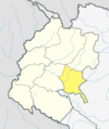
Panchadewal Binayak is a municipality located in Accham District of Sudurpashchim province of Nepal.[2] It is surrounded by Kalikot District of Karnali Province in the East, Kamalbazar in the West, Ramaroshan in the North and Dailekh District in the South.[3]
History
On 10 March 2017 Government of Nepal announced 744 local level units as per the new constitution of Nepal 2015.[4] thus this local level unit came into existence. Total area of the municipality is 147.75 square kilometres (57.05 sq mi) and total population of the municipality (according to 2011 Nepal census) is 27485. The municipality is divided into 9 wards. Kuika (half part), Binayak, Kalikasthan, Layati, Toli, Pulletala, Warla and Kalekanda villages were merged to form this new local level unit.[3]
Demographics
At the time of the 2011 Nepal census, Panchadewal Binayak Municipality had a population of 27,495. Of these, 95.0% spoke Nepali, 3.5% Achhami, 1.3% Magar and 0.1% other languages as their first language.[5]
In terms of ethnicity/caste, 46.9% were Chhetri, 16.3% Hill Brahmin, 14.3% Kami, 13.8% other Dalit, 3.1% Magar, 2.9% Damai/Dholi, 1.5% Thakuri, 0.5% Lohar, 0.4% Sarki, 0.1% other Terai, 0.1% Tharu and 0.1% others.[6]
In terms of religion, 98.0% were Hindu and 1.9% Buddhist.[7]
In terms of literacy, 51.0% could read and write, 4.2% could only read and 44.7% could neither read nor write.[8]
References
- ^ a b c d e f g "Achham District (Municipality profile)" (PDF). www.cbs.gov.np (in Nepali). Central Bureau of Statistics. 2018. pp. 99, 100, 101, 102, 103. Retrieved 9 February 2020.
- ^ "Panchadewal Binayak municipality". Retrieved 8 February 2020.
- ^ a b "पञ्चदेवल विनायक नगरपालिकाकाे एक संक्षिप्त परिचय" [A short Introduction of Panchdewal Binayak Municipality] (in Nepali). Retrieved 8 February 2020.
- ^ "New local level structure comes into effect from today". www.thehimalayantimes.com. The Himalayan Times. 10 March 2017. Retrieved 17 July 2018.
- ^ NepalMap Language [1]
- ^ NepalMap Caste [2]
- ^ NepalMap Religion [3]
- ^ NepalMap Literacy [4]
External links
- http://mofald.gov.np/sites/default/files/News_Notices/Final%20District%201-75%20Corrected%20Last%20for%20RAJPATRA.pdf
- https://web.archive.org/web/20180831065451/http://103.69.124.141/
- http://kathmandupost.ekantipur.com/news/2017-08-11/govt-prepares-to-add-9-more-local-levels-in-province-2.html