Rineyville, Kentucky
Census-designated place in Kentucky, United States
37°44′58″N 85°58′12″W / 37.74944°N 85.97000°W / 37.74944; -85.97000 (2020)
40162

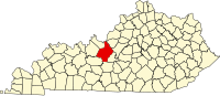
Rineyville is an unincorporated community and census-designated place (CDP) in Hardin County, Kentucky, United States. It is located 7 miles (11 km) northwest of Elizabethtown. The population was 3,039 as of the 2020 Census. The Paducah and Louisville Railway runs north and south through the community.
There is no formal city government; a Magistrate, elected to the Hardin County Fiscal Court, represents the unincorporated community. The primary law enforcement agency for Rineyville is the Kentucky State Police – Post 4 in Elizabethtown. The Rineyville Fire Department, created in 1979, consists of over 30 volunteers from the community. Some neighboring communities include Vine Grove to the north, Radcliff to the northeast, and Cecilia to the south.
Rineyville is named for past resident Zachariah Riney, the first school teacher of young Abraham Lincoln.[3]
Demographics
| Census | Pop. | Note | %± |
|---|---|---|---|
| 2020 | 3,039 | — | |
| U.S. Decennial Census[4] | |||
References
- ^ "2020 U.S. Gazetteer Files". United States Census Bureau. Retrieved March 18, 2022.
- ^ U.S. Geological Survey Geographic Names Information System: Rineyville, Kentucky
- ^ Rennick, Robert M. Kentucky Place Names. University Press of Kentucky. p. 251. ISBN 0-8131-2631-2.
- ^ "Census of Population and Housing". Census.gov. Retrieved June 4, 2016.
External links
- Kentucky State Police – Post 4
- Rineyville Volunteer Fire Department
- v
- t
- e
Municipalities and communities of Hardin County, Kentucky, United States
County seat: Elizabethtown
unincorporated
communities
‡This populated place also has portions in an adjacent county or counties
- Kentucky portal
- United States portal
Authority control databases | |
|---|---|
| International |
|
| National |
|
 | This Hardin County, Kentucky state location article is a stub. You can help Wikipedia by expanding it. |
- v
- t
- e


