River Cover
River in North Yorkshire, England
54°11′2″N 2°1′29″W / 54.18389°N 2.02472°W / 54.18389; -2.02472
• location
• coordinates
• elevation
The River Cover is a river in the Yorkshire Dales in North Yorkshire, England. The Yorkshire Dales Rivers Trust[1] has a remit to conserve the ecological condition of the River Cover. The river forms a limestone dale with ancient woodlands.[2]
Course
The source of the river lies in the shake holes that are found between Buckden Pike and Great Whernside that feed many small gills, such as East Stone Gill, West Stone Gill and Downs Gill. Where these conjoined flows meet Hazel Bank Gill is where the river becomes known as the River Cover. It flows in a north-east direction past Woodale, Braidley and Horsehouse. It turns to the north north-east towards Gammersgill before returning north-east between West Scrafton and Carlton, North Yorkshire. Immediately east of Agglethorpe, the river turns east until it joins the River Ure south-east of Middleham.[3]
The river flows north eastwards for 14 miles (22 km) and drains an area covering over 20,130 acres (8,146 ha).[4][5]
Ecology
The river is home for brown trout and grayling.[6]
Geology
The river runs along a U-shaped glacial valley over Great Scar limestone with Yoredale rock forming the valley sides. It is a gently meandering river with a characteristic stony channel and beaches leading to wooded low banks. The wooded areas extend up into the many gills that join the river.[2]
Lists
Tributaries
|
| Settlements
| Crossings
|
Gallery
-
 River Cover from St Simons Bridge
 -
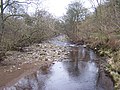
 River Cover
 -
 Stepping stones over the River Cover
 -
 Caygill footbridge over the River Cover


See also
- Coverdale
- Rivers of the United Kingdom
References
- ^ "Yorkshire Dales Rivers Trust". www.yorkshiredalesriverstrust.org.uk. Retrieved 13 October 2011.
- ^ a b "Geology" (PDF). Archived from the original (PDF) on 24 December 2010. Retrieved 13 October 2011.
- ^ "OpenData support | OS Tools & Support".
- ^ "Coverdale Catch (Trib of Ure)". environment.data.gov.uk. Retrieved 24 September 2019.
- ^ "Team goes against the flow". The Yorkshire Post. 22 October 2012. Retrieved 24 September 2019.
- ^ "Ecology (Fish)". Retrieved 13 October 2011.
External links
Wikimedia Commons has media related to River Cover.
- v
- t
- e
Rivers of Yorkshire
- Aire
- Arkle Beck
- Bain
- Bedale Beck
- Burn
- Cock Beck
- Cod Beck
- Costa Beck
- Cover
- Crimple Beck
- Derwent
- Dibb
- Doe
- Dove
- Eller Beck
- Esk
- Foss
- Greta (Lune)
- Gypsey Race
- Hertford
- Hodge Beck
- Holgate Beck
- Kyle
- Leven
- Malham Beck
- Nidd
- Oak Beck
- Ouse
- Pickering Beck
- Ramsdale Beck
- Ribble
- Riccall
- Risedale Beck
- Rye
- Sea Cut
- Seph
- Seven
- Skeeby Beck
- Skell
- Skelton Beck
- Skirfare
- Swale
- Tees
- Tutt
- Twiss
- Ure
- Washburn
- Wenning
- Wharfe
- Wiske
| Authority control databases: National |
|
|---|


