Shirinu Rural District
Rural district in Bushehr province, Iran
Rural District in Bushehr, Iran
Shirinu Rural District Persian: دهستان شیرینو | |
|---|---|
| 27°39′02″N 52°28′50″E / 27.65056°N 52.48056°E / 27.65056; 52.48056[1] | |
| Country | Iran |
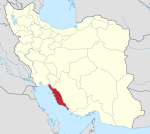
| Province | Bushehr |
| County | Kangan |
| District | Siraf |
| Capital | Shirinu |
| Time zone | UTC+3:30 (IRST) |
Shirinu Rural District (Persian: دهستان شیرینو) is in Siraf District of Kangan County, Bushehr province, Iran. Its capital is the village of Shirinu,[2] whose population at the 2016 National Census was 9,976 people in 1,087 households.[3]
In 2017, Taheri Rural District and the city of Bandar Siraf were separated from the Central District in the establishment of Siraf District, which was divided into two rural districts.[2]
 Iran portal

References
- ^ OpenStreetMap contributors (31 March 2023). "Shirinu Rural District (Kangan County)" (Map). OpenStreetMap. Retrieved 31 March 2023.
- ^ a b Jahangiri, Ishaq (7 December 1397). "Approval letter regarding country divisions in Jam and Kangan Counties in Bushehr province". Islamic Parliament Research Center of the Islamic Republic of Iran (in Persian). Ministry of Interior, Council of Ministers. Archived from the original on 13 March 2019. Retrieved 31 March 2023.
- ^ "Census of the Islamic Republic of Iran, 1395 (2016)". AMAR (in Persian). The Statistical Center of Iran. p. 18. Archived from the original (Excel) on 3 August 2017. Retrieved 19 December 2022.
- v
- t
- e
Bushehr Province, Iran
| Asaluyeh County | |
|---|---|
| Bushehr County | |
| Dashtestan County | |
| Dashti County | |
| Deylam County | |
| Deyr County | |
| Ganaveh County | |
| Jam County | |
| Kangan County | |
| Tangestan County |
- Ghavam water tank (Ab Anbar of Ghavam)
- Khourmoj fire temple
- Boraazjan Castle
- Siraf
- Seensiz
- Rishahr
- Chehelkhaneh cave
- Bardak Siah Palace
- Saadat Mozaffari School
- Rais Ali Museum
- Bushehr anthropology Museum
- Gur-e-Dokhtar
| |||||||||||
|---|---|---|---|---|---|---|---|---|---|---|---|
| Capital | |||||||||||
| Districts |
| ||||||||||


