Spijk, West Betuwe
Village in Gelderland, Netherlands
51°51′18″N 5°0′28″E / 51.85500°N 5.00778°E / 51.85500; 5.00778 (2021)[1]
4211[1]
Spijk is a village in the Dutch province of Gelderland. It is a part of the municipality of West Betuwe, about 3 km northeast of Gorinchem.
Spijk was a separate municipality between 1817–1855, when it became part of Heukelum. At that time, it was still part of the province of South Holland.[3]
History
It was first mentioned in 1135 as Wichero de Spic, and means foreland.[4] The village developed as a stretched out dike village along the Linge. The tower of the Dutch Reformed Church was built around 1250 and enlarged around 1500. The church dates from around 1500. It was restored between 1965 and 1969.[5] Spijk was home to 392 people in 1840.[6]
Gallery
-
 Farm in Spijk
 -
 Pumping station
 -
 Worker's houses
 -
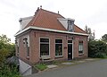 House on the dike


References
- ^ a b c "Kerncijfers wijken en buurten 2021". Central Bureau of Statistics. Retrieved 24 March 2022.
- ^ "Postcodetool for 4211BA". Actueel Hoogtebestand Nederland (in Dutch). Het Waterschapshuis. Retrieved 24 March 2022.
- ^ Ad van der Meer and Onno Boonstra, Repertorium van Nederlandse gemeenten, KNAW, 2011.
- ^ "Spijk - (geografische naam)". Etymologiebank (in Dutch). Retrieved 24 March 2022.
Authenticity of the 1129 document is in doubt
- ^ Ronald Stenvert & Sabine Broekhoven (2000). "Spijk" (in Dutch). Zwolle: Waanders. ISBN 90 400 9406 3. Retrieved 24 March 2022.
- ^ "Spijk (Betuwe)". Plaatsengids (in Dutch). Retrieved 24 March 2022.
 | This Gelderland location article is a stub. You can help Wikipedia by expanding it. |
- v
- t
- e


