Sterksel
Village in North Brabant, Netherlands
51°21′2″N 5°36′43″E / 51.35056°N 5.61194°E / 51.35056; 5.61194 Netherlands
 North Brabant
 Heeze-Leende
 (2021)[1]
6029[1]
Sterksel is a village in the southern Netherlands, near Eindhoven. It lies within the municipality Heeze-Leende. It's the smallest village of three in the municipality. The spoken language is "Heeze-en-Leendes", a distinct dialect within the East Brabantian dialect group, quite similar to colloquial Dutch.
History
The village was first mentioned between 1196 and 1198 as Sterkesele. The suffix means "single roomed house". The first part can either be sterk (strong) or sterke (young cow).[3] Sterksel is an agricultural community from the Middle Ages. Between 1798 until 1915, it was owned by the Pompen family.[4]
Sterksel was home to 99 people in 1840.[5] Broederhuis Providentia is a monastery established in 1915.[4]
Gallery
-
 St Catharina Church
 -
 Villa Ekelhof
 -
 House in Sterksel
 -
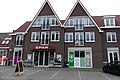 Supermarket


References
- ^ a b c "Kerncijfers wijken en buurten 2021". Central Bureau of Statistics. Retrieved 16 April 2022.
- ^ "Postcodetool for 6029PA". Actueel Hoogtebestand Nederland (in Dutch). Het Waterschapshuis. Retrieved 16 April 2022.
- ^ "Sterksel - (geografische naam)". Etymologiebank (in Dutch). Retrieved 16 April 2022.
- ^ a b Chris Kolman & Ronald Stenvert (1997). Sterksel (in Dutch). Zwolle: Waanders. ISBN 90 400 9945 6. Retrieved 16 April 2022.
- ^ "Sterksel". Plaatsengids (in Dutch). Retrieved 16 April 2022.
External links
- Official Website
Authority control databases | |
|---|---|
| International |
|
| Geographic |
|
- v
- t
- e


