Valleys of Nepal
You can help expand this article with text translated from the corresponding article in Nepali. (February 2021) Click [show] for important translation instructions.
- View a machine-translated version of the Nepali article.
- Machine translation, like DeepL or Google Translate, is a useful starting point for translations, but translators must revise errors as necessary and confirm that the translation is accurate, rather than simply copy-pasting machine-translated text into the English Wikipedia.
- Do not translate text that appears unreliable or low-quality. If possible, verify the text with references provided in the foreign-language article.
- You must provide copyright attribution in the edit summary accompanying your translation by providing an interlanguage link to the source of your translation. A model attribution edit summary is
Content in this edit is translated from the existing Nepali Wikipedia article at [[:ne:नेपालका उपत्यकाहरू]]; see its history for attribution. - You may also add the template
{{Translated|ne|नेपालका उपत्यकाहरू}}to the talk page. - For more guidance, see Wikipedia:Translation.
class=notpageimage|
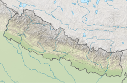
Map of NepalThe valleys of Nepal (Nepali: नेपालका उपत्यकाहरू) are situated in three physiographic regions: Terai, Hilly, and Himal.[1] As Nepal is landlocked by India on three sides and China's Tibet Autonomous Region to the north, much of its population is concentrated in valleys and lowlands.[2]
List
B
- Barun Valley
C
- Chitwan Valley
D
- Dang Valley Inner Terai Valleys of Nepal
I
K
- Kathmandu Valley
- Khaptad Valley
- Khumbu Valley
L
- Langtang Valley
M
- Manang Valley
N
- Namche Valley
P
- Pokhara Valley
- Pyuthan Valley
- Poon Valley
- Panchkhal Valley
S
- Surkhet valley
R
T
See also
References
Wikimedia Commons has media related to Valleys of Nepal.


