West Virginia Route 63
State highway in West Virginia, United States
Major junctions WV 12 in Alderson
 US 219 near Ronceverte
 US 60 in Caldwell
←  WV 62 WV 62 | →  I-64 I-64 |
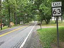
West Virginia Route 63 is an east–west state highway located within Greenbrier County, West Virginia. The western terminus of the route is at West Virginia Route 12 in Alderson. The eastern terminus is at U.S. Route 60 in Caldwell. From Alderson to Ronceverte, it is known as the Highland Trail.[2]
Route 63 is concurrent with U.S. Route 219 from Ronceverte to near Organ Cave. It crosses the Greenbrier River during this concurrency.[3]
Major intersections
The entire route is in Greenbrier County.
| Location | mi | km | Destinations | Notes | |
|---|---|---|---|---|---|
| Alderson | WV 12 – Pence Springs, Talcott, Alta | ||||
| Ronceverte |  US 219 north – Lewisburg US 219 north – Lewisburg | west end of US 219 overlap | |||
| Organ Cave |  US 219 south – Rich Creek, VA US 219 south – Rich Creek, VA | east end of US 219 overlap | |||
| Caldwell | US 60 – Lewisburg, White Sulphur Springs | ||||
1.000 mi = 1.609 km; 1.000 km = 0.621 mi
| |||||
References
- ^ Distance calculated using Microsoft MapPoint mapping software.
- ^ "Fort Spring · West Virginia 24970". Google Maps. Retrieved 17 August 2014.
- ^ West Virginia Official State Highway Map 2006/2007 -- Distributed by State of West Virginia
Wikimedia Commons has media related to West Virginia Route 63.
- v
- t
- e


