Wörth an der Donau
| Wörth an der Donau comune | |
|---|---|
| Wörth a.d.Donau | |
 | |
 | |
| Localizzazione | |
| Stato |  Germania Germania |
| Land |  Baviera Baviera |
| Distretto |  Alto Palatinato Alto Palatinato |
| Circondario | Ratisbona |
| Territorio | |
| Coordinate | 49°00′03″N 12°24′04″E49°00′03″N, 12°24′04″E (Wörth an der Donau) |
| Altitudine | 320–630 m s.l.m. |
| Superficie | 52,25 km² |
| Abitanti | 4 472[1] (2006-12-31) |
| Densità | 85,59 ab./km² |
| Altre informazioni | |
| Cod. postale | 93084–93086 |
| Prefisso | 09482 |
| Fuso orario | UTC+1 |
| Codice Destatis | 09 3 75 210 |
| Targa | R |
| Cartografia | |
  Wörth an der Donau | |
| Sito istituzionale | |
| Modifica dati su Wikidata · Manuale | |
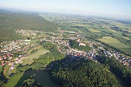
Wörth an der Donau (ufficialmente Wörth a.d.Donau) è un comune tedesco di 4.472 abitanti, situato nel land della Baviera.
Altri progetti
Altri progetti
- Wikimedia Commons
 Wikimedia Commons contiene immagini o altri file su Wörth an der Donau
Collegamenti esterni
- Sito ufficiale, su woerth-donau.de.


V · D · M Comuni del circondario di Ratisbona  | |
|---|---|
| Città | Hemau · Neutraubling · Wörth an der Donau |
| Comuni | Alteglofsheim · Altenthann · Aufhausen · Bach an der Donau · Barbing · Beratzhausen · Bernhardswald · Brennberg · Brunn · Deuerling · Donaustauf · Duggendorf · Hagelstadt · Holzheim am Forst · Kallmünz · Köfering · Laaber · Lappersdorf · Mintraching · Mötzing · Nittendorf · Obertraubling · Pentling · Pettendorf · Pfakofen · Pfatter · Pielenhofen · Regenstauf · Riekofen · Schierling · Sinzing · Sünching · Tegernheim · Thalmassing · Wenzenbach · Wiesent · Wolfsegg · Zeitlarn |
| Controllo di autorità | VIAF (EN) 155941140 · LCCN (EN) n80128202 · GND (DE) 4108495-0 · J9U (EN, HE) 987007559627505171 · WorldCat Identities (EN) lccn-n80128202 |
|---|
 Portale Germania: accedi alle voci di Wikipedia che parlano della Germania
- ^ Ente statistico della Baviera - Dati sulla popolazione


