Slope County
| Slope County i Nord-Dakota | |||
|---|---|---|---|
 | |||
| Grunnlagt | 14. januar 1915[1] | ||
| Fylkessete | Amidon[1] | ||
| Største by | Marmarth | ||
| Areal - Totalt - Land - Vann | 3 157,77 km² 3 154,45 km² 3,32 km² | ||
| Befolkning - Tetthet | 713 (2006) 0,23 innb./km² | ||
 Slope County 46°27′N 103°28′V | |||
Slope County på Commons | |||
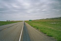
Slope County er et fylke i den amerikanske delstaten Nord-Dakota. Det ligger i den sørvestlige delen av staten og grenser mot Billings County i nord, Stark County i nordøst, Hettinger County i øst, Adams County i sørøst Bowman County i sør og mot Golden Valley County i nordvest. Det har også grense mot delstaten Montana i vest.
Slope Countys totale areal er 3 157,77 km² hvorav 3,32 km² er vann. Ved folketellingen i 2010 hadde fylket 727[1] innbyggere, og administrasjonssenteret ligger i Amidon[1] og det største stedet er Marmarth.
Historie
Fylket ble grunnlagt 14. januar 1915.[1]
Referanser
- ^ a b c d e «Find a County». National Association of Counties. Besøkt 26. juni 2015.
Eksterne lenker
- (en) Offisielt nettsted

- (en) Slope County, North Dakota – kategori av bilder, video eller lyd på Commons
 | Golden Valley County (NV) | Billings County (N) | Stark County (NØ) | |
| Fallon County (Montana) (V) |  | Hettinger County (Ø) | ||
 Slope County, Nord-Dakota Slope County, Nord-Dakota | ||||
 | ||||
| Bowman County (S) | Adams County (SØ) |
Portal: USA
| |||
|---|---|---|---|
 | Adams · Barnes · Benson · Billings · Bottineau · Bowman · Burke · Burleigh · Cass · Cavalier · Dickey · Divide · Dunn · Eddy · Emmons · Foster · Golden Valley · Grand Forks · Grant · Griggs · Hettinger · Kidder · LaMoure · Logan · McHenry · McIntosh · McKenzie · McLean · Mercer · Morton · Mountrail · Nelson · Oliver · Pembina · Pierce · Ramsey · Ransom · Renville · Richland · Rolette · Sargent · Sheridan · Sioux · Slope · Stark · Steele · Stutsman · Towner · Traill · Walsh · Ward · Wells · Williams |  | |


