Lewis County, Idaho
- För andra countyn med samma namn, se Lewis County.
| Lewis County | |
| County | |
| Land |  USA USA |
|---|---|
| Delstat |  Idaho Idaho |
| Huvudort | Nezperce |
| Största stad | Kamiah |
| Area | 1 243 km² (2010)[1] |
| - land | 1 240 km² (100%) |
| - vatten | 2,4 km² (0%) |
| Folkmängd | 3 821 (2010)[2] |
| Befolkningstäthet | 3,1 invånare/km² |
| Grundat | 1911 |
| - uppkallat efter | Meriwether Lewis |
| Tidszon | PST (UTC-8) |
| - sommartid | PDT (UTC-7) |
| FIPS-kod | 16061 |
| Geonames | 5598527 |
 Läge i delstaten Idaho. | |
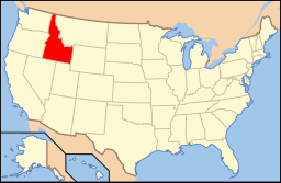 Delstatens läge i USA. | |
| Fotnoter: Naco - Find a county | |
Lewis County är ett administrativt område i delstaten Idaho, USA, med 3 821 invånare (2010). Den administrativa huvudorten (county seat) är Nezperce.
Geografi
Enligt United States Census Bureau har countyt en total area på 1 243 km². 1 241 km² av den arean är land och 2 km² är vatten.
Angränsande countyn
- Nez Perce County - nord, väst
- Idaho County - syd, öst
- Clearwater County - nordöst
Referenser
- ^ ”2010 Census U.S. Gazetteer Files for Counties”. U.S. Census Bureau. Arkiverad från originalet den 5 juli 2012. https://www.webcitation.org/68vYLbou5?url=http://www.census.gov/geo/www/gazetteer/files/Gaz_counties_national.txt. Läst 5 juli 2012.
- ^ ”State & County QuickFacts, Lewis County, Idaho” (på engelska). U.S. Census Bureau. Arkiverad från originalet den 13 juli 2011. https://www.webcitation.org/609dzo02Q?url=http://quickfacts.census.gov/qfd/states/16/16061.html. Läst 6 juli 2011.
Bilder & media
| ||||||||||

|


