^”2010 Census Gazetteer Files”. US Census Bureau. Arkiverad från originalet den 14 juli 2012. https://www.webcitation.org/699nOulzi?url=http://www.census.gov/geo/www/gazetteer/files/Gaz_places_national.txt. Läst 14 juli 2012.
^ [a b] New London (city) Arkiverad 12 juli 2012 hämtat från the Wayback Machine.. State & County Quick Facts. Läst 8 augusti 2012.
^”2010 ZIP Code Tabulation Area (ZCTA) Relationship Files”. U.S. Census Bureau. 24 maj 2010. Arkiverad från originalet den 25 augusti 2012. https://www.webcitation.org/6ABdwXxbq?url=http://www.census.gov/geo/www/2010census/zcta_rel/zcta_place_rel_10.txt. Läst 25 augusti 2012.
Externa länkar
Wikimedia Commons har media som rör New London, Connecticut.

 USA
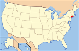
USA 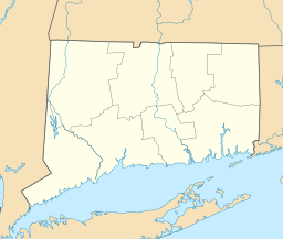

 Wikimedia Commons har media som rör New London, Connecticut.Bilder & media


