Batayporã
Municipality in Central-West, Brazil

Flag

Coat of arms

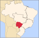
Location in Mato Grosso do Sul state
(2020[1])
Batayporã is a municipality located in the Brazilian state of Mato Grosso do Sul. Its population is 11,349 (2020) and its area is 1,828 km2.
The town was founded in 1954 by Jan Antonín Baťa as part of his expansion of the Bata shoe company, founded by his brother Tomáš.[2]
Batayporã is surrounded by agricultural land. It is located south of Anaurilândia at the junction of MS-395 and MS-134 (BR376), paved single-lane highways.[citation needed]
Other towns in Brazil linked to Baťa include Anaurilândia, Batatuba, Bataguassu, and Mariápolis.
References
- v
- t
- e

Capital: Campo Grande
Centro Norte de Mato Grosso do Sul
| Alto Taquari | |
|---|---|
| Campo Grande |
|
Leste de Mato Grosso do Sul
| Cassilândia | |
|---|---|
| Nova Andradina | |
| Paranaíba | |
| Três Lagoas |
Pantanal Sul Mato-Grossense
| Aquidauana | |
|---|---|
| Baixo Pantanal |
Sudoeste de Mato Grosso do Sul
| Bodoquena | |
|---|---|
| Dourados | |
| Iguatemi |
| Authority control databases: National |
|
|---|
 | This Mato Grosso do Sul, Brazil location article is a stub. You can help Wikipedia by expanding it. |
- v
- t
- e


