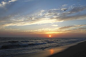
According to the California Protected Areas Database (CPAD), in the state of California, United States, there are over 14,000 inventoried protected areas administered by public agencies and non-profits. In addition, there are private conservation areas and other easements.[1] They include almost one-third of California's scenic coastline, including coastal wetlands, estuaries, beaches, and dune systems. The California State Parks system alone has 270 units and covers 1.3 million acres (5,300 km2), with over 280 miles (450 km) of coastline, 625 miles (1,006 km) of lake and river frontage, nearly 18,000 campsites, and 3,000 miles (5,000 km) of hiking, biking, and equestrian trails.
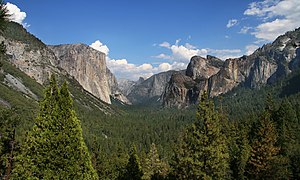
Obtaining an accurate total of all protected land in California and elsewhere is a complex task. Many parcels have inholdings, private lands within the protected areas, which may or may not be accounted for when calculating total area. Also, occasionally one parcel of land is included in two or more inventories. Over 90% of Yosemite National Park for example, is listed both as wilderness by the National Wilderness Preservation System, and as national park land by the National Park Service. The Cosumnes River Preserve is an extreme example, owned and managed by a handful of public agencies and private landowners, including the Bureau of Land Management, the County of Sacramento and The Nature Conservancy. Despite the difficulties, the CPAD gives the total area of protected land at 49,294,000 acres (199,490 km2), or 47.05% of the state (not including easements); a considerable amount for the most populous state in the country.
The Bureau of Land Management’s National Landscape Conservation System (NLCS) includes over 850 federally recognized areas and in California, manages 15,500,000 acres (63,000 km2) of public lands, nearly 15% of the state's land area.[3] The National Landscape Conservation System is composed of several types of units: national monuments (distinct from the same-named units within the National Park System), national conservation areas, forest reserves, outstanding natural areas, national scenic and historic trails, wilderness, wilderness study areas, and others.
The National Marine Sanctuary System is managed by the Office of Marine Sanctuaries, of the National Oceanic and Atmospheric Administration. California has four of the thirteen U.S. National Marine Sanctuaries:
National Wildlife Refuge (NWR) is a designation for certain protected areas of the United States managed by the United States Fish and Wildlife Service. The National Wildlife Refuge System is an extensive system of public lands and waters set aside to conserve America's fish, wildlife and plants. Many of the state's refuges are important stops and destinations for millions of migrating birds along the Pacific Flyway corridor. One, the Butte Sink Wildlife Management Area, has the highest density of waterfowl in the world.[6] There are 38 units in the refuge system in California, including both wildlife refuges and wildlife management areas, divided into 9 different regional areas. Combined the areas equal about 440,000 acres (1,800 km2).
Rivers designated as Wild and Scenic are administered by one of four federal land management agencies: The Bureau of Land Management, The National Park Service, The U.S. Fish and Wildlife Service or The U.S. Forest Service.[7] There are 22 rivers in California with portions designated as Wild and Scenic, with 23 designations in all (the American River has two separate designations, one for the North Fork, and one for the Lower section).[8] Listed in miles.
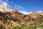
There are 149 wilderness areas in California totaling just over 15,000,000 acres (61,000 km2).[9] The largest is Death Valley Wilderness at 3,055,413 acres (12,364.82 km2), the largest federally designated wilderness in the continental United States, and the smallest is the Rocks and Islands Wilderness at 19 acres (77,000 m2). The wilderness areas are managed by the US Forest Service, Bureau of Land Management, US Fish and Wildlife Service and the National Park Service. Rarely, if ever, are designated wilderness areas stand alone protected areas, and thus their areas are, in all likelihood, already accounted for in the various agencies' inventories.
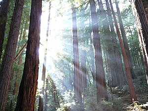
California has 17 U.S. National Forests, one special management unit (Lake Tahoe) and parts of 3 other National Forests. Total combined area of the forests is 20,061,888 acres (81,187.58 km2) and covers over 19% of the state. The largest forest entirely within the state is Shasta-Trinity National Forest, at 2,209,832 acres (8,942.87 km2), the smallest is Cleveland National Forest at 460,000 acres (1,900 km2). The Lake Tahoe Basin Management Unit is not precisely a national forest in the conventional sense. Instead the Forest Service manages the land with particular attention paid to Lake Tahoe and its relationship with the forests surrounding it, with emphasis on erosion control management and watershed restoration, among other more conventional forest management activities. It is the smallest of the Forest Service units in California, with 191,000 acres (770 km2) in its jurisdiction split between California and Nevada.
The California Department of Forestry and Fire Protection (CAL FIRE) operates eight Demonstration State Forests totaling 71,000 acres. The forests represent the most common forest types in the state. The State Forests grow approximately 75 million board feet of timber annually and harvest an average of 30 million board feet each year, enough to build 3,000 single-family homes. Revenue from these harvests fund the management of the State Forests. In addition, the forests provide research and demonstration opportunities for natural resource management, while providing public recreation opportunities, fish and wildlife habitat, and watershed protection. Activities include: experimental timber harvesting techniques, watershed restoration, mushroom collecting, hunting, firewood gathering, cone collecting for seed, a variety of university research projects, horseback riding, camping, mountain biking, and hiking.[10]
The California Department of Parks and Recreation maintains over 270 protected areas, which include almost one-third of California's scenic coastline, including coastal wetlands, estuaries, beaches, and dune systems. The state parks system covers 1.3 million acres (5,300 km2), with over 280 miles (450 km) of coastline, 625 miles (1,006 km) of lake and river frontage, nearly 18,000 campsites; and 3,000 miles (5,000 km) of hiking, biking, and equestrian trails.[11] The largest is Anza-Borrego State Park at 600,000 acres (2,400 km2), making it one of the largest state parks in the country. The smallest, Watts Towers, owned by the State Park system but managed by the Los Angeles Cultural Affairs Department,[12] is a mere 0.1-acre (400 m2).
Most cities and counties in California, as in elsewhere, own and operate open spaces of various types, the most recognizable being the city and county park. By far the largest inventory of protected land held by a municipal agency belongs to the Los Angeles Department of Water and Power, with just over 400,000 acres (1,600 km2) in its jurisdiction.[19] The largest city park in the state is Mission Trails Regional Park in San Diego at 5,800 acres (23 km2), although there are several county and regional parks that are larger. Total land owned by municipal agencies is roughly 1,500,000 acres (6,100 km2) acres.
In addition to the many public lands are about 550,000 acres (2,200 km2) of privately owned preserves. The Wildlands Conservancy is the largest owner of protected lands with 180,686 acres (731.21 km2). The Nature Conservancy has been involved in over 100 projects in the state since 1958.[20] Many are eventually transferred to public agencies, but the Conservancy still owns and maintains several substantial preserves, including the Gray Davis/Dye Creek Preserve, Vina Plains Preserve, McCloud River Preserve, Cosumnes River Preserve, Santa Cruz Island, Irvine Ranch Wildlands and the Santa Rosa Plateau Ecological Reserve. The largest private preserve is the 93,000 acres (380 km2) Wind Wolves Preserve owned by the aforementioned Wildlands Conservancy.[21] In total, there are many dozens of land trust and conservation organizations active in California, with thousands of acres preserved on public and private lands through their efforts.[22] A few that operate entirely or substantially in the state are the Peninsula Open Space Trust, the Northern Sierra Partnership, the Sempervirens Fund, the Sacramento Valley Conservancy and the Wilderness Land Trust.
The 20 largest landholders, according to the CPAD 2018a Statistics Report:
Agency
Total lands owned (in acres)*
U.S. Forest Service U.S. Bureau of Land Management U.S. National Park Service California Department of Parks and Recreation California Department of Fish and Wildlife California State Lands Commission City of Los Angeles - Dept. of Water and Power U.S. Fish and Wildlife Service U.S. Bureau of Reclamation The Wildlands Conservancy The Nature Conservancy Imperial Irrigation District East Bay Regional Park District California Department of Water Resources The Conservation Fund - California California Department of Forestry and Fire Protection City of San Diego U.S. Army Corps of Engineers City and County of San Francisco Public Utilities Commission County of Orange
^BLM California data page. Archived 2009-01-11 at the Wayback Machine
^Administration, US Department of Commerce, National Oceanic and Atmospheric. "NOAA's National Ocean Service: National Marine Sanctuaries". oceanservice.noaa.gov. Retrieved 8 April 2018.{{cite web}}: CS1 maint: multiple names: authors list (link)
^"Butte Sink Wildlife Management Area". U.S. Fish & Wildlife Service. Archived from the original on 2010-05-22. Retrieved 2010-04-24.
^"Interagency Wild & Scenic Rivers Council". Wild & Scenic Rivers Council. Archived from the original on 2010-06-10. Retrieved 2010-04-21.
^"California". National Wild and Scenic River System. Retrieved 2017-05-07.
^"Wilderness areas in California". Archived from the original on 2010-06-12. Retrieved 2009-10-03.
^"A State Park System is Born". California State Parks. Retrieved 2007-10-07.
^"Watts Towers of Simon Rodia SHP". California State Parks. Retrieved 2010-05-17.
^"State Parks Along California's North Coast Redwoods and History" (PDF). California Department of Parks and Recreation.
^"State Designated Wilderness Programs in the United States" (PDF). International Journal of Wilderness. Archived from the original (PDF) on 2010-07-10. Retrieved 2010-04-24.
^"DFW Regions". California Department of Fish and Wildlife (DFG) website. Retrieved 2008-02-19.
^"Lands Inventory Fact Sheet". California DFG website. Retrieved 2008-02-19.
^"Wildlife Areas". California DFW website. Retrieved 2008-02-19.
^"Ecological Reserves". California DFW website. Retrieved 2008-02-19.
^"CPAD Release notes". GreenInfo Network. Archived from the original on 2010-05-14. Retrieved 2010-05-17.
^"The Nature Conservancy in California". The Nature Conservancy. Archived from the original on 2011-03-01. Retrieved 2010-04-24.
^"Wind Wolves Preserve". Wildlands Conservancy. Archived from the original on 2016-03-02. Retrieved 2016-09-07.
^"California Member Land Trusts". The California Council of Land Trusts. Retrieved 2016-09-07.