White Eagle, Oklahoma
Unincorporated community and Census designated place in Oklahoma, United States
36°37′36″N 97°04′52″W / 36.62667°N 97.08111°W / 36.62667; -97.08111 (2020)
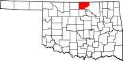
White Eagle is an unincorporated community and Census designated place in Kay County, Oklahoma, United States.
History
White Eagle was named for the Ponca principal chief, White Eagle (ca. 1840-1914), who led the Ponca to their reservation in Indian Territory.[3] Other names for the town are Ponca, White Eagle Agency, and Whiteagle.[2]
Geography
White Eagle is located in southeastern Kay County, just east of the Salt Fork and approximately one and one quarter miles west-northwest of the confluence of the Salt Fork with the Arkansas River. The community is on U.S. Route 177, five miles south of Ponca City.[4]
Demographics
| Census | Pop. | Note | %± |
|---|---|---|---|
| 2020 | 520 | — | |
| U.S. Decennial Census[5] | |||
Government
White Eagle is the headquarters for the Ponca Tribe of Indians of Oklahoma.[6]
Education
It is in Ponca City Public Schools,[7] which operates Ponca City High School.
Notable people
- Paladine Roye, Ponca painter, 1946-2001
References
- ^ "ArcGIS REST Services Directory". United States Census Bureau. Retrieved September 20, 2022.
- ^ a b c U.S. Geological Survey Geographic Names Information System: White Eagle, Oklahoma
- ^ Johansen, Bruce E. White Eagle. Oklahoma Historical Society's Encyclopedia of Oklahoma History & Culture. 2009 (15 August 2009)
- ^ Ponca City SE, OK, 7.5 Minute Topographic Quadrangle, USGS, 1968
- ^ "Census of Population and Housing". Census.gov. Retrieved June 4, 2016.
- ^ Van de Logt, Mark. Ponca. Oklahoma Historical Society's Encyclopedia of Oklahoma History & Culture. 2009 (15 August 2009)
- ^ "2020 CENSUS - SCHOOL DISTRICT REFERENCE MAP: Kay County, OK" (PDF). U.S. Census Bureau. pp. 1-2 (PDF p. 2-3/3). Retrieved January 27, 2024. - Text list
- v
- t
- e
Municipalities and communities of Kay County, Oklahoma, United States
County seat: Newkirk
- Nardin
- Peckham
- Tonkawa Tribal Housing
- White Eagle
communities
- Oklahoma portal
- United States portal
| Authority control databases |
|
|---|
 | This Oklahoma state location article is a stub. You can help Wikipedia by expanding it. |
- v
- t
- e


